Cof Cymru: National Historic Assets of Wales · Wales
Road Bridge over former Padarn Railway
Y Felinheli, Gwynedd, Wales
A Grade II listed building in Penscoins, Y Felinheli, Gwynedd, designated on 18 April 1997.
The record
- Designation
- Listed building, Grade II
- Broad class
- Transport
- Date of designation
- 18 April 1997
- Locality
- Penscoins
- Town
- Y Felinheli
- Community
- Y Felinheli
- Unitary authority
- Gwynedd
- Country
- Wales
- Coordinates
- 53.18651, -4.19330
- Cadw reference
- 18346
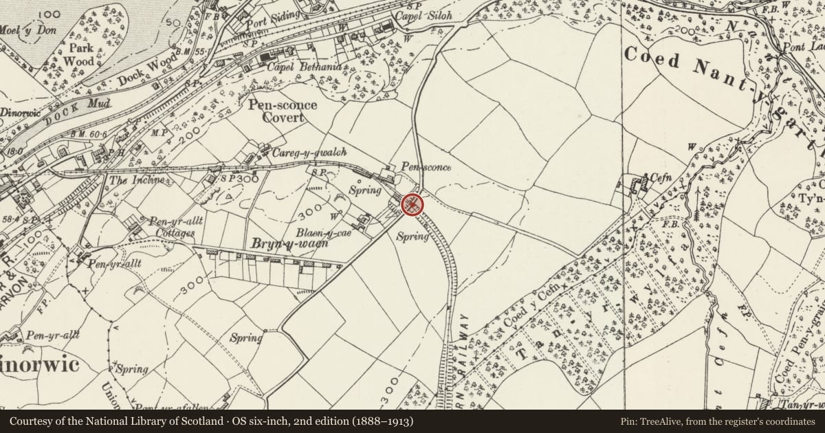
Slide toward Today to fade the historical sheet and see the modern map underneath.
David Rumsey Map Collection, Stanford LibrariesDavid Rumsey Map Collection, Stanford LibrariesDavid Rumsey Map Collection, Stanford LibrariesDavid Rumsey Map Collection, Stanford LibrariesDavid Rumsey Map Collection, Stanford Libraries
5 historical maps cover this location, the earliest the 1896 map "Sheet 7. Ordnance Survey of England and Wales." (David Rumsey Map Collection, Stanford Libraries).
Historical maps covering this location
- 1896 · Sheet 7. Ordnance Survey of England and Wales. (David Rumsey Map Collection, Stanford Libraries)
- 1899 · 106 Bangor (Outline) (David Rumsey Map Collection, Stanford Libraries)
- 1899 · 106 Bangor (Hills) (David Rumsey Map Collection, Stanford Libraries)
- 1901 · Sheet 9 and 10. (David Rumsey Map Collection, Stanford Libraries)
- 1919 · Sheet 41. Anglesey. (David Rumsey Map Collection, Stanford Libraries)
Cadw's description
Location
The bridge at Penscoins, carries a minor road running N from Bethel, over the disused Padarn railway.
History
Road bridge over deep cutting of the Padarn railway from the Dinorwic quarry to Port Dinorwic, the line built between June 1841 and December 1843. From 1843 until the introduction of steam locomotives in 1848, the slates from the quarry were drawn on wagons pulled by horses. From just W of Penscoins, the slate wagons were taken to the quayside via an inclined plane. The railway and the port system closed on 27 October 1961.
Exterior
Slightly humped rubble stone tall bridge with parapet, the latter is some 22m long and 1m high. The arch is approximately 5m high and 4m wide at track level. Slate arch ring and stone voussoirs both sides. Bridge has buttress on NW side to full height.
Reason for designation
Included as one of the best preserved features of historic importance in connection with the transport system for the slate trade of Port Dinorwic.
Nearby in the register
- Engine Shed on former Padarn RailwayTransportunder 1 mi
- Cae GlasDomesticunder 1 mi
- SingrigDomesticunder 1 mi
- SingrigDomesticunder 1 mi
Other entries of the same register within about three miles of this one, by straight line.