Cof Cymru: National Historic Assets of Wales · Wales
Field Barn S of Hafod Ifan
Ysbyty Ifan, Conwy, Wales
A Grade II listed building in Hafod Ifan, Ysbyty Ifan, Conwy, designated on 8 April 1997.
The record
- Designation
- Listed building, Grade II
- Broad class
- Agriculture and Subsistence
- Date of designation
- 8 April 1997
- Locality
- Hafod Ifan
- Community
- Ysbyty Ifan
- Unitary authority
- Conwy
- Country
- Wales
- Coordinates
- 53.01489, -3.73949
- Cadw reference
- 18326
Slide toward Today to fade the historical sheet and see the modern map underneath.
David Rumsey Map Collection, Stanford LibrariesDavid Rumsey Map Collection, Stanford LibrariesLlyfrgell Genedlaethol Cymru – The National Library of WalesDavid Rumsey Map Collection, Stanford LibrariesDavid Rumsey Map Collection, Stanford Libraries
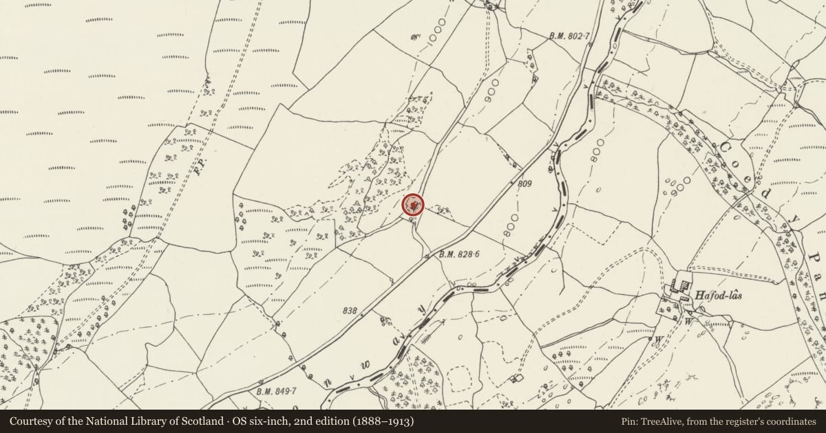
5 historical maps cover this location, the earliest the 1795 map "To Sir Watkin Williams-Wynn Bart ... the map of the six counties of North Wales is most humbly inscribed by his obedient humble servant" (Llyfrgell Genedlaethol Cymru – The National Library of Wales).
Historical maps covering this location
- 1795 · To Sir Watkin Williams-Wynn Bart ... the map of the six counties of North Wales is most… (Llyfrgell Genedlaethol Cymru – The National Library of Wales)
- 1830 · V.3:11-15:XV. Britisches Reich. A. Kon: England. b. Frstenthum Wales: Shire: 37-40 (David Rumsey Map Collection, Stanford Libraries)
- 1883 · Watershed map England, Wales 3. (David Rumsey Map Collection, Stanford Libraries)
- 1898 · 120 Corwen (Hills) (David Rumsey Map Collection, Stanford Libraries)
- 1901 · Sheet 9 and 10. (David Rumsey Map Collection, Stanford Libraries)
Cadw's description
Location
Located on a hillside approximately 700m SW of Hafod Ifan and accessed via a track leading a short distance NW from the road; sited across the slope.
Exterior
Late C17 or early C18 field barn associated originally with Hafod Ifan farm. Long rectangular rubble building, partly boulder-built and with projecting boulder plinth to E; renewed slate roof with rubble gable parapets. 5 plain entrances to S side, that to far R blocked and that second from L with ribbed, boarded door; expressed timber lintels to central three. Loading bay to the rear with exposed timber lintel and modern frame. Ventilation slit to E gable apex with a line of projecting stones beneath, probably relating to the securing of the thatch on the primary roof.
Interior
4-bay roof with chamfered tie beams and plain, raked struts; mostly replaced purlins and rafters. The truss between bays 1 and 2 is of upper-cruck derivation; earth floor.
Reason for designation
Listed for its special historic interest as a fine late C17/early C18 Snowdonia field barn.
Nearby in the register
- Former house at Hafod IfanDomesticunder 1 mi
- Former Drying HousesIndustrialunder 1 mi
- Bryn YsgolDomesticunder 1 mi
- Bryn YsgolDomesticunder 1 mi
Other entries of the same register within about three miles of this one, by straight line.