Cof Cymru: National Historic Assets of Wales · Wales
Former Dairy-house at Bryn Mwllach
Dolwyddelan, Conwy, Wales
A Grade II listed building in Brynmoel, Dolwyddelan, Conwy, designated on 17 February 1997.
The record
- Designation
- Listed building, Grade II
- Broad class
- Agriculture and Subsistence
- Date of designation
- 17 February 1997
- Locality
- Brynmoel
- Community
- Dolwyddelan
- Unitary authority
- Conwy
- Country
- Wales
- Coordinates
- 53.06141, -3.86671
- Cadw reference
- 18256
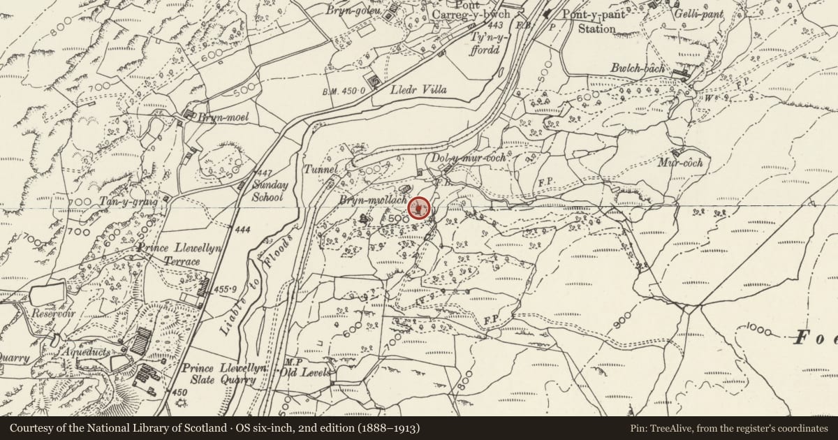
Slide toward Today to fade the historical sheet and see the modern map underneath.
David Rumsey Map Collection, Stanford LibrariesDavid Rumsey Map Collection, Stanford LibrariesDavid Rumsey Map Collection, Stanford LibrariesLlyfrgell Genedlaethol Cymru – The National Library of WalesDavid Rumsey Map Collection, Stanford Libraries
5 historical maps cover this location, the earliest the 1795 map "To Sir Watkin Williams-Wynn Bart ... the map of the six counties of North Wales is most humbly inscribed by his obedient humble servant" (Llyfrgell Genedlaethol Cymru – The National Library of Wales).
Historical maps covering this location
- 1795 · To Sir Watkin Williams-Wynn Bart ... the map of the six counties of North Wales is most… (Llyfrgell Genedlaethol Cymru – The National Library of Wales)
- 1883 · Watershed map England, Wales 3. (David Rumsey Map Collection, Stanford Libraries)
- 1896 · Sheet 7. Ordnance Survey of England and Wales. (David Rumsey Map Collection, Stanford Libraries)
- 1899 · 119 Snowdon (Hills) (David Rumsey Map Collection, Stanford Libraries)
- 1901 · Sheet 9 and 10. (David Rumsey Map Collection, Stanford Libraries)
Cadw's description
Location
Located some 100m SE of, and behind Bryn Mwllach, set against a rock outcrop by a stream.
Exterior
Small, late C19 dairy-house of rectangular plan; slate rubble construction with slated, gabled roof and some surviving render. Recessed 16-pane original sash window to NW gable face; C20 recessed, boarded door to SW side and a small ventilator to the rear (SE) gable. On the NE side, an external iron waterwheel, formerly overshot and with wooden paddles; by J and E Roberts, Llanrwst Foundry (in raised letters).
Interior
The interior was not inspected at the time of survey (11/96).
Reason for designation
Included for group value with Bryn Mwllach and for its special historic interest as one of very few known examples of surviving in situ work by the Llanrwst foundry.
Nearby in the register
- Bryn MwllachDomesticunder 1 mi
- Former House and Byre at Dol-y-Mur GochDomesticunder 1 mi
- Bryn-moelDomesticunder 1 mi
- Bridge and Causeway to Former Quarry at Chwarel-y-Fedw.Transportunder 1 mi
Other entries of the same register within about three miles of this one, by straight line.