Cof Cymru: National Historic Assets of Wales · Wales
Capel Isaf
Dolwyddelan, Conwy, Wales
A Grade II listed building in Dolwyddelan, Conwy, designated on 17 February 1997.
The record
- Designation
- Listed building, Grade II
- Broad class
- Religious, Ritual and Funerary
- Date of designation
- 17 February 1997
- Locality
- Dolwyddelan
- Community
- Dolwyddelan
- Unitary authority
- Conwy
- Country
- Wales
- Coordinates
- 53.05127, -3.88467
- Cadw reference
- 18244
Slide toward Today to fade the historical sheet and see the modern map underneath.
David Rumsey Map Collection, Stanford LibrariesDavid Rumsey Map Collection, Stanford LibrariesDavid Rumsey Map Collection, Stanford LibrariesLlyfrgell Genedlaethol Cymru – The National Library of WalesDavid Rumsey Map Collection, Stanford Libraries
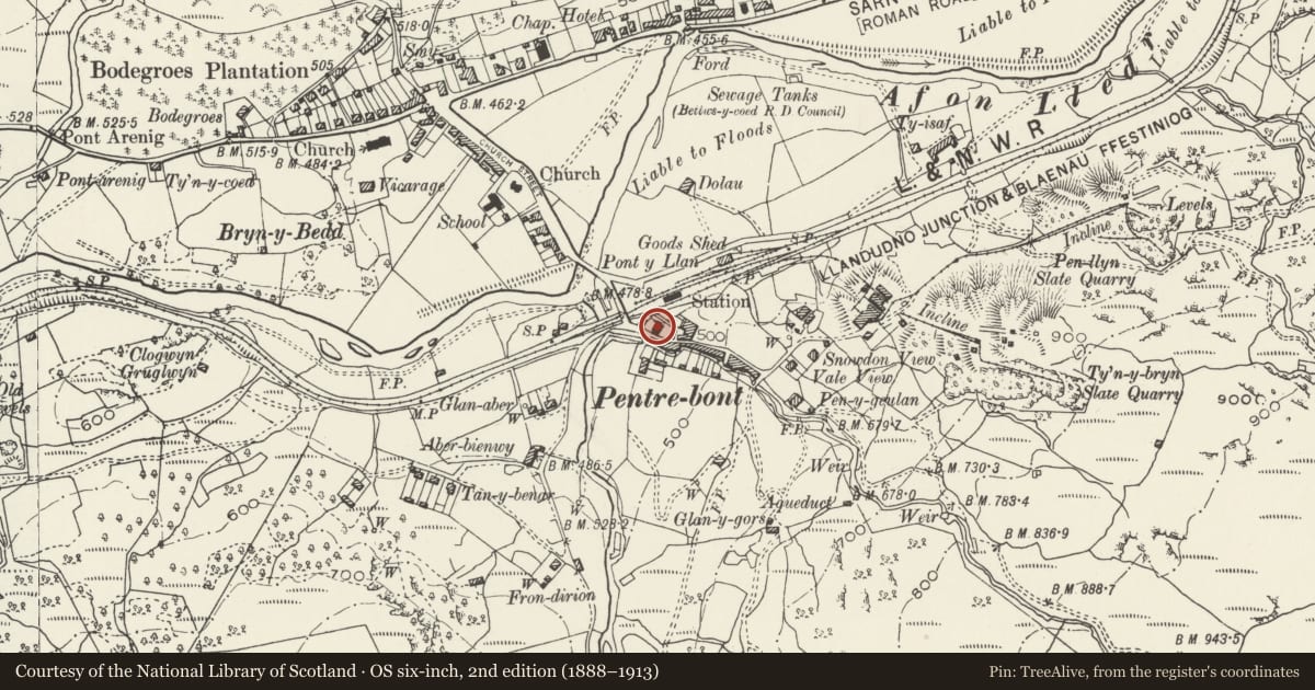
5 historical maps cover this location, the earliest the 1795 map "To Sir Watkin Williams-Wynn Bart ... the map of the six counties of North Wales is most humbly inscribed by his obedient humble servant" (Llyfrgell Genedlaethol Cymru – The National Library of Wales).
Historical maps covering this location
- 1795 · To Sir Watkin Williams-Wynn Bart ... the map of the six counties of North Wales is most… (Llyfrgell Genedlaethol Cymru – The National Library of Wales)
- 1883 · Watershed map England, Wales 3. (David Rumsey Map Collection, Stanford Libraries)
- 1896 · Sheet 7. Ordnance Survey of England and Wales. (David Rumsey Map Collection, Stanford Libraries)
- 1899 · 119 Snowdon (Hills) (David Rumsey Map Collection, Stanford Libraries)
- 1901 · Sheet 9 and 10. (David Rumsey Map Collection, Stanford Libraries)
Cadw's description
Location
At right-angles to the street immediately beyond Pont-y-Llan and overlooking the railway station to the N.
History
c1825; former independent congregationalist chapel with attached minister's house.
Exterior
Square rubble-built chapel with half-hipped slate roof. The NW (entrance) side has arched outer entrances with recessed boarded doors and segmental fanlights; these flank a pair of tall arched windows with multi-pane sashes and marginal glazing. The rear face (SE) has three tall, square-headed, 12-pane recessed sashes, again with marginal glazing; that to the L has only the upper half visible, the lower being obscured by a glazed single-storey lean-to extension. Part-rendered SW upper wall with weathercoursing where the chapel adjoins the manse.
Interior
This was not available for inspection at the time of survey (10/96).
Reason for designation
Included for its special historic interest as a first-half C19 non-conformist chapel with good surviving exterior.
Group value with the adjoining Ty Capel Isaf.
Nearby in the register
- Ty Capel IsafDomesticunder 1 mi
- Pont-y-LlanTransportunder 1 mi
- Church of St. GwyddelanReligious, Ritual and Funeraryunder 1 mi
- The Chocolate House (Formerly Church Hall)Religious, Ritual and Funeraryunder 1 mi
Other entries of the same register within about three miles of this one, by straight line.