Cof Cymru: National Historic Assets of Wales · Wales
Former Stable Complex at Belmont
Llanddoged and Maenan, Conwy, Wales
A Grade II listed building in Belmont, Llanddoged and Maenan, Conwy, designated on 17 February 1997.
The record
- Designation
- Listed building, Grade II
- Broad class
- Agriculture and Subsistence
- Date of designation
- 17 February 1997
- Locality
- Belmont
- Community
- Llanddoged and Maenan
- Unitary authority
- Conwy
- Country
- Wales
- Coordinates
- 53.15957, -3.79720
- Cadw reference
- 18240
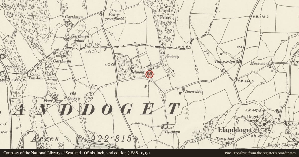
Slide toward Today to fade the historical sheet and see the modern map underneath.
David Rumsey Map Collection, Stanford LibrariesDavid Rumsey Map Collection, Stanford LibrariesDavid Rumsey Map Collection, Stanford LibrariesLlyfrgell Genedlaethol Cymru – The National Library of WalesDavid Rumsey Map Collection, Stanford Libraries
5 historical maps cover this location, the earliest the 1795 map "To Sir Watkin Williams-Wynn Bart ... the map of the six counties of North Wales is most humbly inscribed by his obedient humble servant" (Llyfrgell Genedlaethol Cymru – The National Library of Wales).
Historical maps covering this location
- 1795 · To Sir Watkin Williams-Wynn Bart ... the map of the six counties of North Wales is most… (Llyfrgell Genedlaethol Cymru – The National Library of Wales)
- 1883 · Watershed map England, Wales 3. (David Rumsey Map Collection, Stanford Libraries)
- 1899 · 106 Bangor (Outline) (David Rumsey Map Collection, Stanford Libraries)
- 1899 · 106 Bangor (Hills) (David Rumsey Map Collection, Stanford Libraries)
- 1901 · Sheet 9 and 10. (David Rumsey Map Collection, Stanford Libraries)
Cadw's description
Location
Located 60m W of Belmont, set back to the N of the lane to Llanddoged and facing an agricultural complex.
History
The Belmont stable range was built, or at least added to, by the Rev. John Nanney Wynne, who lived at Belmont as his primary residence from 1795 until his death in 1838. Renowned as a 'keen devotee of the turf', the Reverend aquired the contemporary nick-name of 'the sporting rector of Llangwyfan' and established a racing stables at Belmont which survives as this complex. He was a regular participator in the celebrated Conway races, held at 'the Marsh' until discontinued c1809, and was known to have possessed a large collection of silver cups and trophies, of which he was justifiably proud.
Exterior
Composite stable range of three essential sections; rubble construction with slate roofs, some corrugated iron. The section at L is L-shaped and storied, and has a segmental-arched entrance to L with rough-dressed voussoirs and projecting keystone; flanking 6-pane steel-framed windows; cambered heads as before. Above the entrance a boarded loading bay. To the R the gabled connecting wing with outer boarded entrances and a further loading bay above, including hoist beam. Advanced to the R, an adjoining single-storey block with two further entrances with dressed slate-stone voussoirs to cambered heads; modern stable and boarded doors, plain-glazed window to R. Adjoining flush with this a near-contemporary 2-bay addition with plain window as before and stable door to R; flat slate lintel. The upper R gable end of this section is rebuilt; the roof is of corrugated iron.
Reason for designation
A fine late C18 stable complex associated with the Rev. John Nanney, the 'Racing Rector.'
Group value with other listed items at Belmont.
Nearby in the register
- Barn at BelmontAgriculture and Subsistenceunder 1 mi
- L-shaped agricultural range at BelmontAgriculture and Subsistenceunder 1 mi
- BelmontDomesticunder 1 mi
- Former Stable and Cartshed facing road at Old Rectory.Agriculture and Subsistenceunder 1 mi
Other entries of the same register within about three miles of this one, by straight line.