Cof Cymru: National Historic Assets of Wales · Wales
Old School and Schoolteacher's House
Carew, Pembrokeshire, Wales
A Grade II listed building in Carew Cheriton, Tenby, Carew, Pembrokeshire, designated on 6 February 1997.
The record
- Designation
- Listed building, Grade II
- Broad class
- Education
- Date of designation
- 6 February 1997
- Locality
- Carew Cheriton
- Town
- Tenby
- Community
- Carew
- Unitary authority
- Pembrokeshire
- Country
- Wales
- Coordinates
- 51.69091, -4.82896
- Cadw reference
- 18208
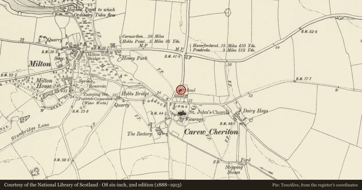
Slide toward Today to fade the historical sheet and see the modern map underneath.
David Rumsey Map Collection, Stanford LibrariesDavid Rumsey Map Collection, Stanford LibrariesDavid Rumsey Map Collection, Stanford LibrariesDavid Rumsey Map Collection, Stanford LibrariesDavid Rumsey Map Collection, Stanford Libraries
5 historical maps cover this location, the earliest the 1636 map "Cornubia : Devonia, Somersetus, Dorcestria, Wiltonia, Glocestria ..." (David Rumsey Map Collection, Stanford Libraries).
Historical maps covering this location
- 1636 · Cornubia : Devonia, Somersetus, Dorcestria, Wiltonia, Glocestria ... (David Rumsey Map Collection, Stanford Libraries)
- 1865 · England and Wales. England No. 6. (David Rumsey Map Collection, Stanford Libraries)
- 1891 · Sheet 10. Ordnance Survey of England and Wales. . (David Rumsey Map Collection, Stanford Libraries)
- 1898 · 228 Haverfordwest (Hills) (David Rumsey Map Collection, Stanford Libraries)
- 1901 · Sheet 13. (David Rumsey Map Collection, Stanford Libraries)
Cadw's description
Location
In the village of Carew Cheriton about 100 m N of the Church. There is a small playground at the N of the school and a garden S of the house.
History
Following the 1870 Education Act, Carew National School was built for £636. The architect was J W Ladd of Pembroke. The School was opened on the 5th of February 1872. It contained a classroom for infants, two classrooms for older children, and a teacher's house. The school remained in use until the 23rd September 1940, when it was temporarily closed because of its proximity to Carew Cheriton Airfield. It was then used as a sick bay for airmen. It was re-opened after the war and continued in use until 1953. The school and the teacher's house are now two private dwellings.
Exterior
The school and the teacher's house adjoin as an L-shaped group, the house planned blind-back to the school. The house is of two storeys and the school is single storey. The house has a small front wing and faces a small private garden to the S. The school and its yard are to the N.
Both buildings are in hammer-dressed limestone with large irregular stones mixed with smaller masonry in informal courses. Slate roofs. Chimneys in similar masonry. The school has tall windows in pairs with two-centred arched heads. The house has sash windows with lintels and two-centred relieving arches in the same limestone as the masonry generally. The main door of the house also has a two-centred arch.
Reason for designation
Listed as a well-preserved village school and teacher's house of the 1870 era.
Nearby in the register
- Old AlmshousesDomesticunder 1 mi
- Old Mortuary ChapelReligious, Ritual and Funeraryunder 1 mi
- St. Mary's Churchyard WallDomesticunder 1 mi
- Church Of St. MaryReligious, Ritual and Funeraryunder 1 mi
Other entries of the same register within about three miles of this one, by straight line.