Cof Cymru: National Historic Assets of Wales · Wales
Public Conveniences
Pillgwenlly, Newport, Wales
A Grade II listed building in Pillgwenlly, Newport, designated on 31 January 1997.
The record
- Designation
- Listed building, Grade II
- Broad class
- Water Supply and Drainage
- Date of designation
- 31 January 1997
- Locality
- Pillgwenlly
- Town
- Newport
- Community
- Pillgwenlly
- Unitary authority
- Newport
- Country
- Wales
- Coordinates
- 51.57542, -2.98758
- Cadw reference
- 18177
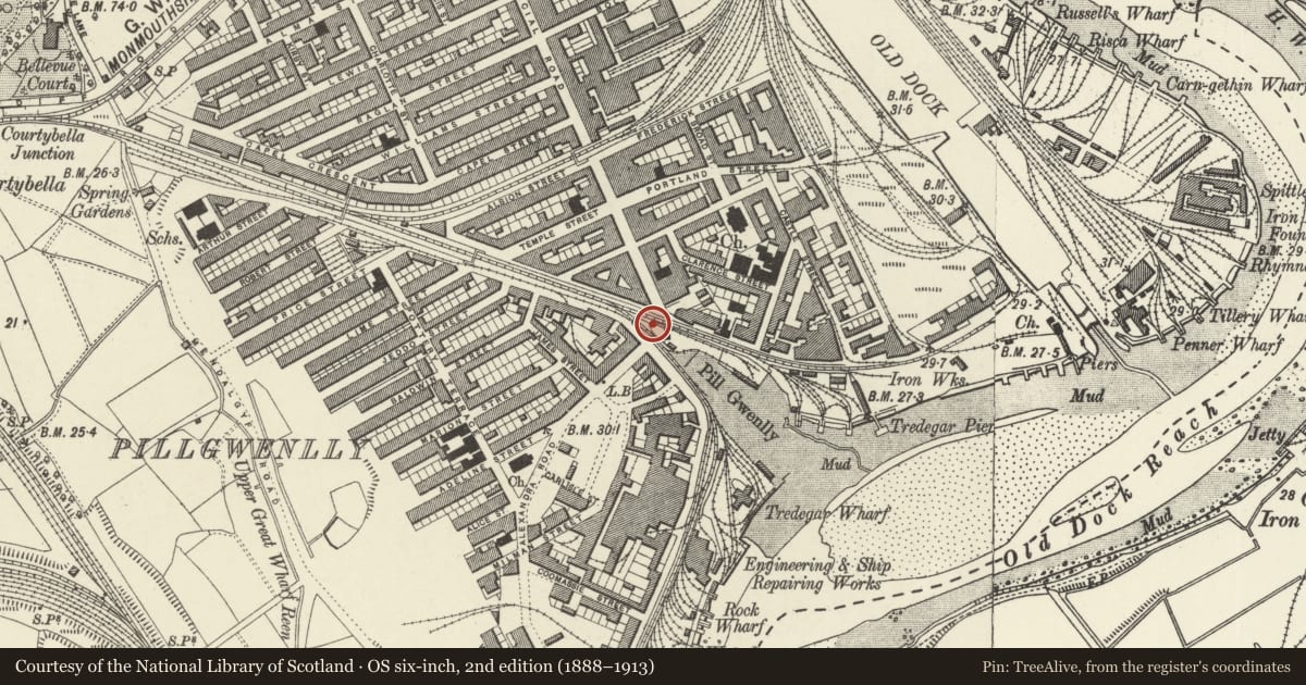
Slide toward Today to fade the historical sheet and see the modern map underneath.
David Rumsey Map Collection, Stanford LibrariesDavid Rumsey Map Collection, Stanford LibrariesDavid Rumsey Map Collection, Stanford LibrariesDavid Rumsey Map Collection, Stanford LibrariesDavid Rumsey Map Collection, Stanford Libraries
5 historical maps cover this location, the earliest the 1636 map "Cornubia : Devonia, Somersetus, Dorcestria, Wiltonia, Glocestria ..." (David Rumsey Map Collection, Stanford Libraries).
Historical maps covering this location
- 1636 · Cornubia : Devonia, Somersetus, Dorcestria, Wiltonia, Glocestria ... (David Rumsey Map Collection, Stanford Libraries)
- 1865 · England and Wales. England No. 6. (David Rumsey Map Collection, Stanford Libraries)
- 1895 · Sheet 11. Ordnance Survey of England and Wales. (David Rumsey Map Collection, Stanford Libraries)
- 1906 · 249 Newport (Hills) (David Rumsey Map Collection, Stanford Libraries)
- 1913 · Sheet 102. Newport. (David Rumsey Map Collection, Stanford Libraries)
Cadw's description
Location
Located at the junction of Courtybella Terrace, Mill Parade and Church Street, opposite the old Tredegar Dry Dock Offices at the S end of Commercial Road.
History
An Edwardian, single storey public convenience.
Exterior
Roughly triangular shaped with flanking entrances, both marked "GENTLEMEN". Constructed of red brick with terracotta detailing and rendered panels. Pitched, slated roof with raised ventilator to ridge. Front elevation has a squat, louvered Venetian window with moulded terracotta hood and sill. Baluster pilasters flanking central opening. Pedimented gable with moulded terracotta cornice and porthole opening set within, with moulded terracotta surround. Flanking brick pilasters with moulded terracotta caps. The two rear elevations are blind.
Interior
White glazed tiling throughout with surviving original, curved white ceramic urinal and fittings.
Reason for designation
Listed grade II as a very good example of a surviving Edwardian public convenience having strong architectural character and group value with the Tredegar Dry Dock Offices opposite.
Nearby in the register
- Catholic Church of St MichaelReligious, Ritual and Funeraryunder 1 mi
- Baltic Oil WorksCommercialunder 1 mi
- Waterloo Hotel PHCommercialunder 1 mi
- Transporter Bridge including E and W anchor chambersTransportunder 1 mi
Other entries of the same register within about three miles of this one, by straight line.