Cof Cymru: National Historic Assets of Wales · Wales
5 Town Hall
Offa, Wrexham, Wales
A Grade II listed building in Offa, Wrexham, designated on 16 June 1980.
The record
- Designation
- Listed building, Grade II
- Broad class
- Domestic
- Date of designation
- 16 June 1980
- Community
- Offa
- Unitary authority
- Wrexham
- Country
- Wales
- Coordinates
- 53.04480, -2.99355
- Cadw reference
- 1816
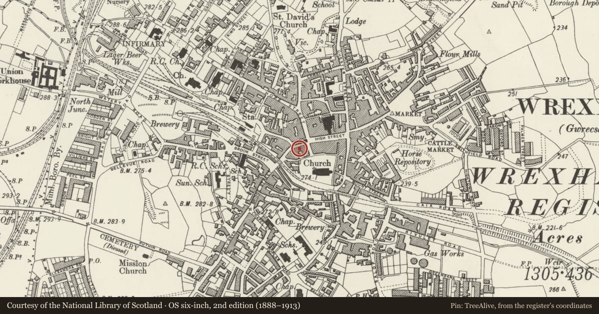
Slide toward Today to fade the historical sheet and see the modern map underneath.
David Rumsey Map Collection, Stanford LibrariesDavid Rumsey Map Collection, Stanford LibrariesDavid Rumsey Map Collection, Stanford LibrariesDavid Rumsey Map Collection, Stanford LibrariesDavid Rumsey Map Collection, Stanford Libraries
5 historical maps cover this location, the earliest the 1608 map "(13) Cambriae Typus." (David Rumsey Map Collection, Stanford Libraries).
Historical maps covering this location
- 1608 · (13) Cambriae Typus. (David Rumsey Map Collection, Stanford Libraries)
- 1883 · Watershed map England, Wales 3. (David Rumsey Map Collection, Stanford Libraries)
- 1898 · 121 Wrexham (Hills) (David Rumsey Map Collection, Stanford Libraries)
- 1898 · 121 Wrexham (Outline) (David Rumsey Map Collection, Stanford Libraries)
- 1901 · Sheet 9 and 10. (David Rumsey Map Collection, Stanford Libraries)
Cadw's description
Location
On the south side of the street adjacent to its junction with Church Street, and forming a single build with No 7.
History
Built as a house, and probably originally forming part of a larger property with No. 7. Probably early C16, subdivided from the original property c1800, the rear range added or rebuilt c1900.
Exterior
Render over timber frame, the rear wing brick, with slate roofs throughout. Square panelled framing revealed in upper gable wall when adjacent property was demolished. 2 storeys, 2 window range with shallow gable over left hand upper window. Shop front by Pollard of London inserted in 1927: Painted bronze framework to plate glass windows, the entrance to the shop itself recessed to maximize window display area, which is symmetrically planned to incorporate a central island display unit.
Interior
Traces of the original timber framed structure are visible at first floor level: cambered tie beam with queen post and collar roof in upper gable wall, and central king post and strut truss (partially cut through). Traces of wind braces visible in rear slope of roof, and possibly on front slope also, but plastered over.
Reason for designation
An important survivor of late medieval Wrexham, forming a historically significant group with Nos 7 and 9 Town Hill, and with a fine example of an early C20 shop front.
Nearby in the register
- 7 Town HillDomesticunder 1 mi
- Dodman'sDomesticunder 1 mi
- 9 Church StreetDomesticunder 1 mi
- 10 Church StreetDomesticunder 1 mi
Other entries of the same register within about three miles of this one, by straight line.