Cof Cymru: National Historic Assets of Wales · Wales
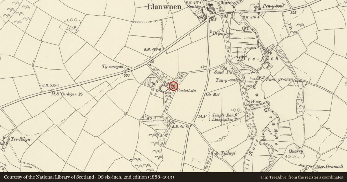
Castell-du
Llanwnnen, Ceredigion, Wales
A Grade II listed building in Llanwnnen, Lampeter, Ceredigion, designated on 20 December 1996.
The record
- Designation
- Listed building, Grade II
- Broad class
- Domestic
- Date of designation
- 20 December 1996
- Locality
- Llanwnnen
- Town
- Lampeter
- Community
- Llanwnnen
- Unitary authority
- Ceredigion
- Country
- Wales
- Coordinates
- 52.10057, -4.14586
- Cadw reference
- 18079
Slide toward Today to fade the historical sheet and see the modern map underneath.
David Rumsey Map Collection, Stanford LibrariesDavid Rumsey Map Collection, Stanford LibrariesDavid Rumsey Map Collection, Stanford LibrariesDavid Rumsey Map Collection, Stanford LibrariesDavid Rumsey Map Collection, Stanford Libraries
5 historical maps cover this location, the earliest the 1608 map "(13) Cambriae Typus." (David Rumsey Map Collection, Stanford Libraries).
Historical maps covering this location
- 1608 · (13) Cambriae Typus. (David Rumsey Map Collection, Stanford Libraries)
- 1830 · V.3:11-15:XV. Britisches Reich. A. Kon: England. b. Frstenthum Wales: Shire: 37-40 (David Rumsey Map Collection, Stanford Libraries)
- 1899 · 195 Lampeter (Hills) (David Rumsey Map Collection, Stanford Libraries)
- 1901 · Sheet 14. (David Rumsey Map Collection, Stanford Libraries)
- 1919 · Sheet 78. Lampeter. (David Rumsey Map Collection, Stanford Libraries)
Cadw's description
Location
Situated some 400m SW of Llanwnnen, between the A475 and the B4337, with entrance drives from both these roads.
History
Country house of 1831 built for Thomas Hughes. Said to be dated 1831 on a roof-truss in rear wing. Described as modern in 1833. Estate sold c1931.
Exterior
Whitewashed roughcast rubble stone with slate hipped roofs and roughcast end stacks. Front range two-storey, three-window, with deep flat eaves, 12-pane hornless sashes, stone sills, and C20 centre door and overlight. There are marks of a long lost porch on the front. Windowless W wall. Big whitewashed NE rear wing with massive external N end stack, the stack stepped back three times on right and stepped out once on left. 12-pane sash to ground floor left, C20 window to right. W side has 6-panel door in lean-to porch, in angle to right, and C20 window each floor to left. E side has stair-light to left and 12-pane sash each floor to right.
Interior
Main SE and SW rooms with 6-panel doors and shutters. Centre hall with fanlight over N end door, to stair hall set off to right, in rear wing. Dog-leg stick-baluster stair with turned newels and ramped rail. Rear wing fireplace said to have large covered beam.
Reason for designation
Listed as a dated smaller late Georgian country-house of well-preserved regional character.
Nearby in the register
- Outbuilding to SW of Castell-duAgriculture and Subsistenceunder 1 mi
- Coach-house and stables at Castell-duDomesticunder 1 mi
- Barn and Cart-Shed range at Castell-duAgriculture and Subsistenceunder 1 mi
- Outbuilding in W angle of Farmyard at Castell-duAgriculture and Subsistenceunder 1 mi
Other entries of the same register within about three miles of this one, by straight line.