Cof Cymru: National Historic Assets of Wales · Wales
Adult Education Centre, University College of North Wales
Offa, Wrexham, Wales
A Grade II listed building in Offa, Wrexham, designated on 22 March 1990.
The record
- Designation
- Listed building, Grade II
- Broad class
- Domestic
- Date of designation
- 22 March 1990
- Community
- Offa
- Unitary authority
- Wrexham
- Country
- Wales
- Coordinates
- 53.04809, -3.00011
- Cadw reference
- 1805
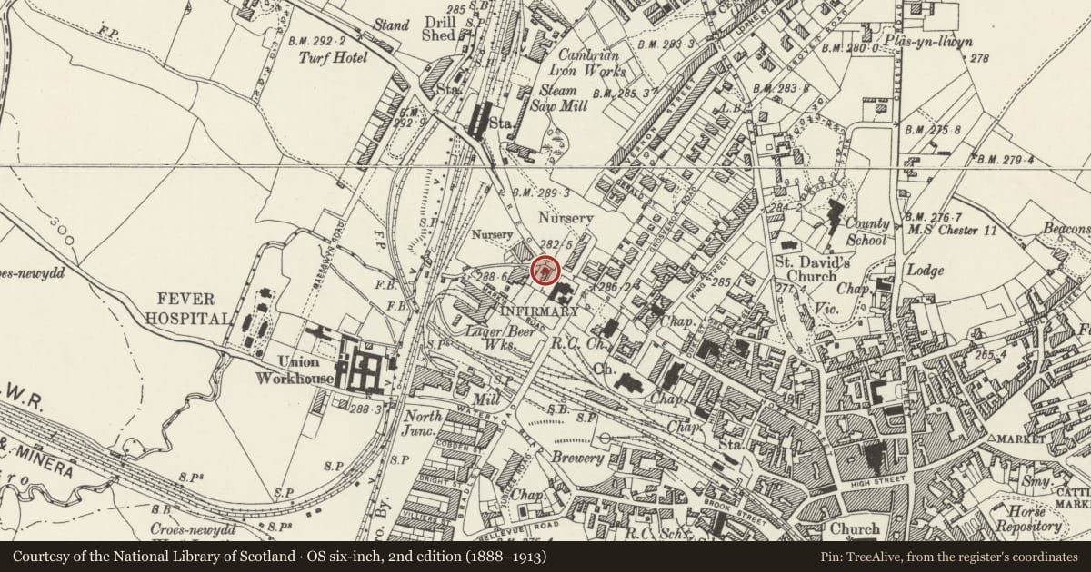
Slide toward Today to fade the historical sheet and see the modern map underneath.
David Rumsey Map Collection, Stanford LibrariesDavid Rumsey Map Collection, Stanford LibrariesDavid Rumsey Map Collection, Stanford LibrariesDavid Rumsey Map Collection, Stanford LibrariesLlyfrgell Genedlaethol Cymru – The National Library of Wales
5 historical maps cover this location, the earliest the 1795 map "To Sir Watkin Williams-Wynn Bart ... the map of the six counties of North Wales is most humbly inscribed by his obedient humble servant" (Llyfrgell Genedlaethol Cymru – The National Library of Wales).
Historical maps covering this location
- 1795 · To Sir Watkin Williams-Wynn Bart ... the map of the six counties of North Wales is most… (Llyfrgell Genedlaethol Cymru – The National Library of Wales)
- 1883 · Watershed map England, Wales 3. (David Rumsey Map Collection, Stanford Libraries)
- 1898 · 121 Wrexham (Hills) (David Rumsey Map Collection, Stanford Libraries)
- 1898 · 121 Wrexham (Outline) (David Rumsey Map Collection, Stanford Libraries)
- 1901 · Sheet 9 and 10. (David Rumsey Map Collection, Stanford Libraries)
Cadw's description
Location
Detached house set forward to the right of the former infirmary and art college buildings. Union Road runs diagonally from junction at right angle.
History
Originally built as a house, but now used as adult education centre. C1850.
Exterior
Flemish bond brickwork with painted stone dressings and hipped slate roof. 2 storeys, symmetrically planned with entrance central to 3 window range. 4-panelled door in architrave with console brackets to entablature hood flanked by sash windows in stressed lugged architraves on each floor with similar window above the doorway. Cornice band carried on triple modillions to eaves. End wall stacks. Similar details to 2-window return to right, with canted bay window added in later C19 or C20.
Reason for designation
A good example of a Victorian town house, with group value with No 49, the former Infirmary.
Nearby in the register
- Former Wrexham InfirmaryHealth and Welfareunder 1 mi
- Offices and Lodge to Wrexham Lager BreweryIndustrialunder 1 mi
- 1 Grosvenor RoadDomesticunder 1 mi
- Presbytery at Catholic Cathedral Church of St MaryReligious, Ritual and Funeraryunder 1 mi
Other entries of the same register within about three miles of this one, by straight line.