Cof Cymru: National Historic Assets of Wales · Wales
Norchard Farm Buildings
Manorbier, Pembrokeshire, Wales
A Grade II listed building in Norchard Farm, Manorbier, Pembrokeshire, designated on 12 March 1996.
The record
- Designation
- Listed building, Grade II
- Broad class
- Agriculture and Subsistence
- Date of designation
- 12 March 1996
- Locality
- Norchard Farm
- Community
- Manorbier
- Unitary authority
- Pembrokeshire
- Country
- Wales
- Coordinates
- 51.66132, -4.77504
- Cadw reference
- 18020
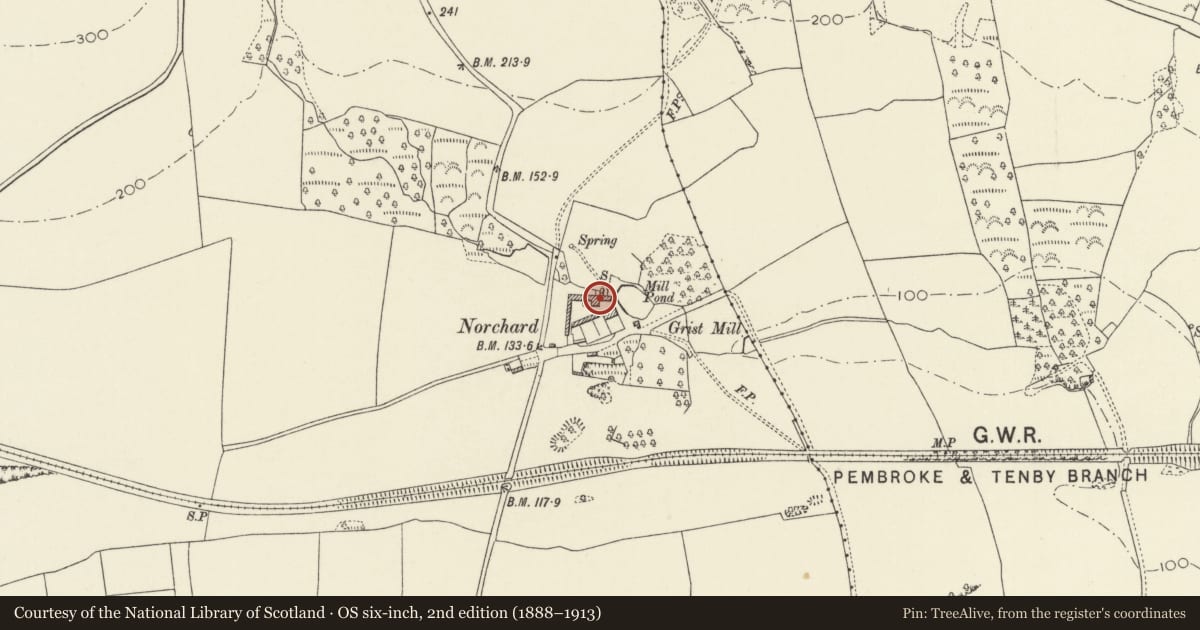
Slide toward Today to fade the historical sheet and see the modern map underneath.
David Rumsey Map Collection, Stanford LibrariesDavid Rumsey Map Collection, Stanford LibrariesDavid Rumsey Map Collection, Stanford LibrariesDavid Rumsey Map Collection, Stanford LibrariesDavid Rumsey Map Collection, Stanford Libraries
5 historical maps cover this location, the earliest the 1636 map "Cornubia : Devonia, Somersetus, Dorcestria, Wiltonia, Glocestria ..." (David Rumsey Map Collection, Stanford Libraries).
Historical maps covering this location
- 1636 · Cornubia : Devonia, Somersetus, Dorcestria, Wiltonia, Glocestria ... (David Rumsey Map Collection, Stanford Libraries)
- 1865 · England and Wales. England No. 6. (David Rumsey Map Collection, Stanford Libraries)
- 1891 · Sheet 10. Ordnance Survey of England and Wales. . (David Rumsey Map Collection, Stanford Libraries)
- 1898 · 245 Pembroke (Hills) (David Rumsey Map Collection, Stanford Libraries)
- 1901 · Sheet 13. (David Rumsey Map Collection, Stanford Libraries)
Cadw's description
Location
Around farmyard to N and W of Norchard farmhouse.
Exterior
To the W of the house and in alignment with it is a large cowshed of 24 ties. C 1890. To the S, with its rear to the private approach lane to the farmhouse, is a cartshed, later used as a cattle shed. To the W, parallel to the public road, is a cart-horse stable built in 1877. To the N, at right-angles to the public road, is a barn (with water wheel at the rear), straw house and open sheds, in 2 abutting ranges. There are remains of small enclosed yards at front. At the E of the group is a nag stable and coach-house. Farm storage and granaries above the cart-horse stable and the N ranges.
All built in local random rubble, with some slate roofing and some parts re-roofed with tiles. Part of the N range roof is modern.
Reason for designation
Listed for group value with Norchard Farmhouse.
Nearby in the register
- NorchardDomesticunder 1 mi
- Corn Mill and MillpondIndustrialunder 1 mi
- Palmerslake FarmhouseDomesticunder 1 mi
- Former Railway Stationmaster's HouseDomesticunder 1 mi
Other entries of the same register within about three miles of this one, by straight line.