Cof Cymru: National Historic Assets of Wales · Wales
Ye Olde Worlde Cafe
Stackpole and Castlemartin, Pembrokeshire, Wales
A Grade II listed building in Bosherston, Stackpole and Castlemartin, Pembrokeshire, designated on 8 February 1996.
The record
- Designation
- Listed building, Grade II
- Broad class
- Domestic
- Date of designation
- 8 February 1996
- Locality
- Bosherston
- Community
- Stackpole and Castlemartin
- Unitary authority
- Pembrokeshire
- Country
- Wales
- Coordinates
- 51.61439, -4.93890
- Cadw reference
- 17984
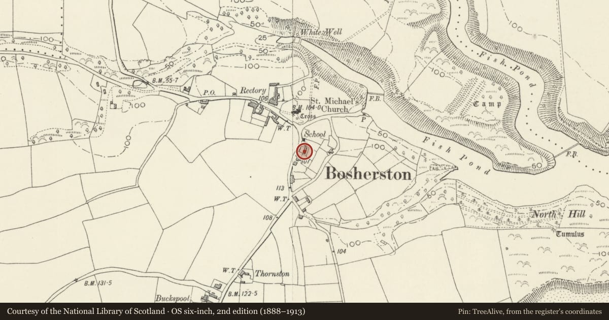
Slide toward Today to fade the historical sheet and see the modern map underneath.
David Rumsey Map Collection, Stanford LibrariesDavid Rumsey Map Collection, Stanford LibrariesDavid Rumsey Map Collection, Stanford LibrariesDavid Rumsey Map Collection, Stanford LibrariesDavid Rumsey Map Collection, Stanford Libraries
5 historical maps cover this location, the earliest the 1636 map "Cornubia : Devonia, Somersetus, Dorcestria, Wiltonia, Glocestria ..." (David Rumsey Map Collection, Stanford Libraries).
Historical maps covering this location
- 1636 · Cornubia : Devonia, Somersetus, Dorcestria, Wiltonia, Glocestria ... (David Rumsey Map Collection, Stanford Libraries)
- 1637 · The fourth table of England. Cornub. Devonia, Somerset etc. (David Rumsey Map Collection, Stanford Libraries)
- 1865 · England and Wales. England No. 6. (David Rumsey Map Collection, Stanford Libraries)
- 1891 · Sheet 10. Ordnance Survey of England and Wales. . (David Rumsey Map Collection, Stanford Libraries)
- 1898 · 245 Pembroke (Hills) (David Rumsey Map Collection, Stanford Libraries)
Cadw's description
Exterior
At E side of the main street of Bosherston village, 100 m S of the churchyard.
Two former coastguard cottages.
Pair of joined cottages, built 1834, two storeys, double-fronted, each with a central entrance and porch, facing W. Local limestone, rendered. Flat arches over openings. All front windows consist of pairs of nine-pane casements within a chamfered frame with mullion. Slate roof. End chimneys and a chimney central to the pair, in limestone. The porch of the left cottage is carried on rough timber posts, that of the right cottage is carried on cast-iron columns. Extended at rear.
Central lobby with staircase. Windows internally have built-in seats in a wall recess below sill.
Listed as a superior pair of estate cottages and an attractive building on a prominent site in the village.
References: NT (Stackpole) files
Dyfed Arch. Trust S&M PRN 26382
Nearby in the register
- St. Michael and All Angels' Church CrossReligious, Ritual and Funeraryunder 1 mi
- St. Michael and All Angel's ChurchReligious, Ritual and Funeraryunder 1 mi
- StyleDomesticunder 1 mi
- Former schoolroom wing to the Old RectoryEducationunder 1 mi
Other entries of the same register within about three miles of this one, by straight line.