Cof Cymru: National Historic Assets of Wales · Wales
Troedyrhiw
Beulah, Ceredigion, Wales
A Grade II listed building in Cwm Cou, Beulah, Ceredigion, designated on 15 March 1996.
The record
- Designation
- Listed building, Grade II
- Broad class
- Domestic
- Date of designation
- 15 March 1996
- Locality
- Cwm Cou
- Community
- Beulah
- Unitary authority
- Ceredigion
- Country
- Wales
- Coordinates
- 52.05421, -4.50572
- Cadw reference
- 17951
Slide toward Today to fade the historical sheet and see the modern map underneath.
David Rumsey Map Collection, Stanford LibrariesDavid Rumsey Map Collection, Stanford LibrariesDavid Rumsey Map Collection, Stanford LibrariesDavid Rumsey Map Collection, Stanford LibrariesDavid Rumsey Map Collection, Stanford Libraries
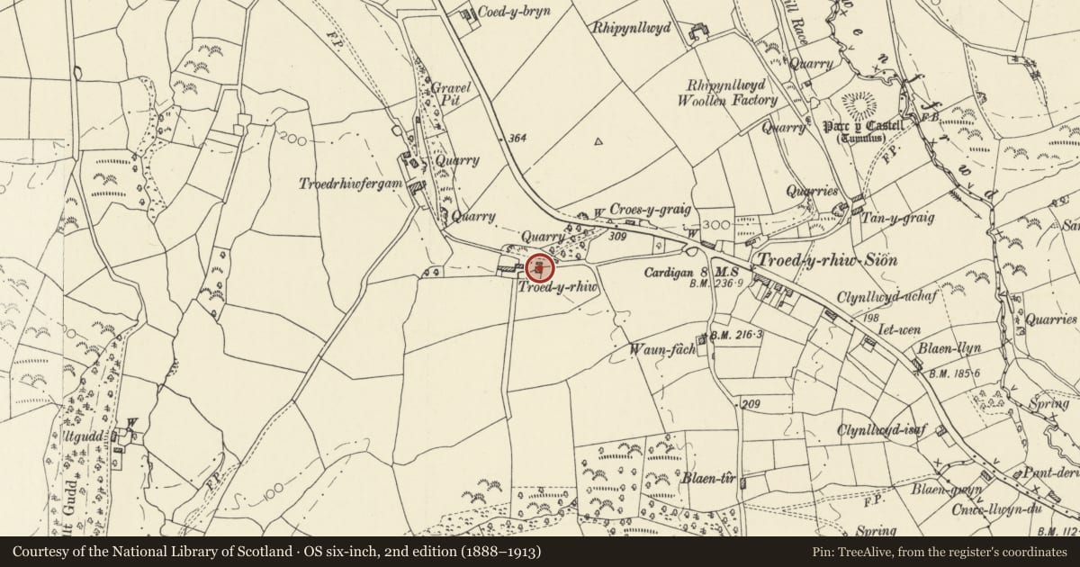
5 historical maps cover this location, the earliest the 1830 map "V.3:11-15:XV. Britisches Reich. A. Kon: England. b. Frstenthum Wales: Shire: 37-40" (David Rumsey Map Collection, Stanford Libraries).
Historical maps covering this location
- 1830 · V.3:11-15:XV. Britisches Reich. A. Kon: England. b. Frstenthum Wales: Shire: 37-40 (David Rumsey Map Collection, Stanford Libraries)
- 1860 · 41. Caermathen. (David Rumsey Map Collection, Stanford Libraries)
- 1899 · 194 Llangranog (Hills) (David Rumsey Map Collection, Stanford Libraries)
- 1901 · Sheet 14. (David Rumsey Map Collection, Stanford Libraries)
- 1919 · Sheet 78. Lampeter. (David Rumsey Map Collection, Stanford Libraries)
Cadw's description
Location
Situated some 1.2 km NW of Cwm Cou, with drive running W off B4570 just W of junction with lane to Penwenallt and Cenarth.
History
Late C17 or early C18 house, of lobby entry plan, very rare in region. Part of Brigstocke of Blaenpant estate in 1841.
Exterior
Rubble stone, formerly roughcast, with graded-slate steep hipped roof, and big centre ridge stack. Stone base, painted brick shafts. Two storeys, double-fronted with C20 casement pair windows, replacing sashes. Rough stone voussoirs to ground floor, timber lintels above. Off-centre ledged door with rough voussoirs. Windowless end walls, outshut rear with C20 hipped additional floor to right.
Interior
Big centre stack with oak-lintel fireplace in N room. C20 fireplace in S room. C20 rear stairs. One window with stone voussoirs in rear internal wall.
Reason for designation
Listed as a very rare local example of the lobby-entry plan, i.e. with main entry to a small lobby, rooms each side, thick centre stack and back-to-back fireplaces.
Nearby in the register
- Milestone on B4570 NW of Cwm CouTransportunder 1 mi
- Troed y Rhiw Sion Defended EnclosurePromontory Fort - inlandunder 1 mi
- Trewen Mill / Felin DrewenIndustrialunder 1 mi
- Capel y Drewen including Vestry RailingsReligious, Ritual and Funeraryunder 1 mi
Other entries of the same register within about three miles of this one, by straight line.