Cof Cymru: National Historic Assets of Wales · Wales
40 High Street
Offa, Wrexham, Wales
A Grade II listed building in Offa, Wrexham, designated on 31 January 1994.
The record
- Designation
- Listed building, Grade II
- Broad class
- Commercial
- Date of designation
- 31 January 1994
- Community
- Offa
- Unitary authority
- Wrexham
- Country
- Wales
- Coordinates
- 53.04492, -2.99280
- Cadw reference
- 1792
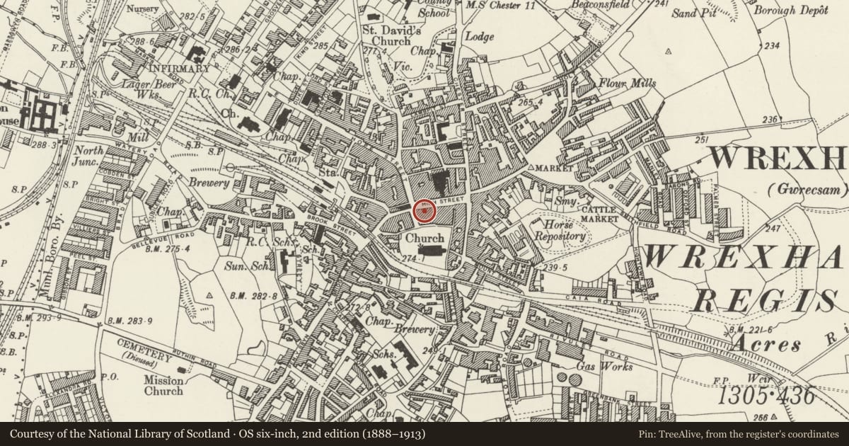
Slide toward Today to fade the historical sheet and see the modern map underneath.
David Rumsey Map Collection, Stanford LibrariesDavid Rumsey Map Collection, Stanford LibrariesDavid Rumsey Map Collection, Stanford LibrariesDavid Rumsey Map Collection, Stanford LibrariesDavid Rumsey Map Collection, Stanford Libraries
5 historical maps cover this location, the earliest the 1608 map "(13) Cambriae Typus." (David Rumsey Map Collection, Stanford Libraries).
Historical maps covering this location
- 1608 · (13) Cambriae Typus. (David Rumsey Map Collection, Stanford Libraries)
- 1883 · Watershed map England, Wales 3. (David Rumsey Map Collection, Stanford Libraries)
- 1898 · 121 Wrexham (Hills) (David Rumsey Map Collection, Stanford Libraries)
- 1898 · 121 Wrexham (Outline) (David Rumsey Map Collection, Stanford Libraries)
- 1901 · Sheet 9 and 10. (David Rumsey Map Collection, Stanford Libraries)
Cadw's description
Location
Part of a continuous building line on the S side of the street, next to No 43 (Trustee Savings Bank) and near the corner with Church Street.
History
According to Palmer, a building on this site was recorded by 1780, but the property was rebuilt to form a single block in the late C19.
Exterior
Painted brick with painted stone dressings and slate roof. 3 storeys, 5 window range. Ground floor entirely renewed c1970, but upper storeys are virtually unaltered. Tall wood mullioned and transomed windows in moulded architraves with deep panelled sill band to 1st floor and segmental pediments carried on brackets over each window. Bracketted sill band to upper storey, with entablature hoods above each window. Angle quoins. Deep eaves band with modillion brackets carrying projecting cornice.
Although the original internal planning and ground floor elevation have been altered, the building represents an interesting example of late C19 commercial development, and forms part of an important group of buildings on High Street.
Nearby in the register
- 41 High StreetCommercialunder 1 mi
- 42 High StreetCommercialunder 1 mi
- 39 High StreetDomesticunder 1 mi
- 38 High StreetCommercialunder 1 mi
Other entries of the same register within about three miles of this one, by straight line.