Cof Cymru: National Historic Assets of Wales · Wales
Former Stables at New Sontley Farm
Marchwiel, Wrexham, Wales
A Grade II listed building in Erddig, Marchwiel, Wrexham, designated on 3 December 1996.
The record
- Designation
- Listed building, Grade II
- Broad class
- Domestic
- Date of designation
- 3 December 1996
- Locality
- Erddig
- Community
- Marchwiel
- Unitary authority
- Wrexham
- Country
- Wales
- Coordinates
- 53.02707, -2.99451
- Cadw reference
- 17877
Slide toward Today to fade the historical sheet and see the modern map underneath.
David Rumsey Map Collection, Stanford LibrariesDavid Rumsey Map Collection, Stanford LibrariesDavid Rumsey Map Collection, Stanford LibrariesDavid Rumsey Map Collection, Stanford LibrariesDavid Rumsey Map Collection, Stanford Libraries
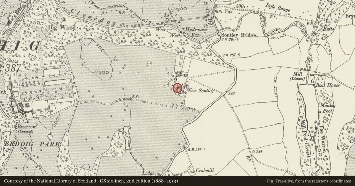
5 historical maps cover this location, the earliest the 1608 map "(13) Cambriae Typus." (David Rumsey Map Collection, Stanford Libraries).
Historical maps covering this location
- 1608 · (13) Cambriae Typus. (David Rumsey Map Collection, Stanford Libraries)
- 1883 · Watershed map England, Wales 3. (David Rumsey Map Collection, Stanford Libraries)
- 1898 · 121 Wrexham (Hills) (David Rumsey Map Collection, Stanford Libraries)
- 1898 · 121 Wrexham (Outline) (David Rumsey Map Collection, Stanford Libraries)
- 1901 · Sheet 9 and 10. (David Rumsey Map Collection, Stanford Libraries)
Cadw's description
Location
Situated at the S side of the forecourt in front of New Sontley Farm, c0.9 km W of Erddig.
History
Early C18 former stables now converted into barns and shippon; the site behind the building is thought to have housed a threshing machine. Part of a larger complex, which included a late C17 house and early C18 coach house. The former stables and coach house were designed as a reflected pair on opposite sides of the square courtyard. New Sontley was bought by Philip Yorke of Erddig from David Roberts c1770 for £7,879.
Exterior
Red brick in Flemish bond with hipped slate roof, heavily rusticated stone quoins, moulded stone plinth, cornice and low parapet. 7 bays wide; central 3 pedimented bays with circular blind opening in the tympanum project forward. Original openings mostly now blocked, a number of vertical ventilation slits to right hand return side. Left hand return elevation again much altered with later openings and vertical ventilations slits. Right hand return elevation similarly altered with to upper storey diamond patterned ventilators.
Attached to rear is a later brick haybarn with 5 wide arches to E elevation.
Interior
Interior not inspected at time of 1996 survey but is said to have been completely remodelled in connection with its present agricultural use.
Reason for designation
Listed as a good example of an early C18 building which retains much of its external character.
Group value with New Sontley Farmhouse.
Nearby in the register
- Combined Pigsties and Hen House at New Sontley FarmAgriculture and Subsistenceunder 1 mi
- New Sontley FarmhouseDomesticunder 1 mi
- Sontley BridgeTransportunder 1 mi
- Sontley BridgeTransportunder 1 mi
Other entries of the same register within about three miles of this one, by straight line.