Cof Cymru: National Historic Assets of Wales · Wales
Telford Milestone (40)
Capel Curig, Conwy, Wales
A Grade II listed building in Pont Cyfyng, Capel Curig, Conwy, designated on 27 November 1996.
The record
- Designation
- Listed building, Grade II
- Broad class
- Transport
- Date of designation
- 27 November 1996
- Welsh name
- Carreg Filltir Telford (40)
- Locality
- Pont Cyfyng
- Town
- Capel Curig
- Community
- Capel Curig
- Unitary authority
- Conwy
- Country
- Wales
- Coordinates
- 53.10053, -3.89856
- Cadw reference
- 17821
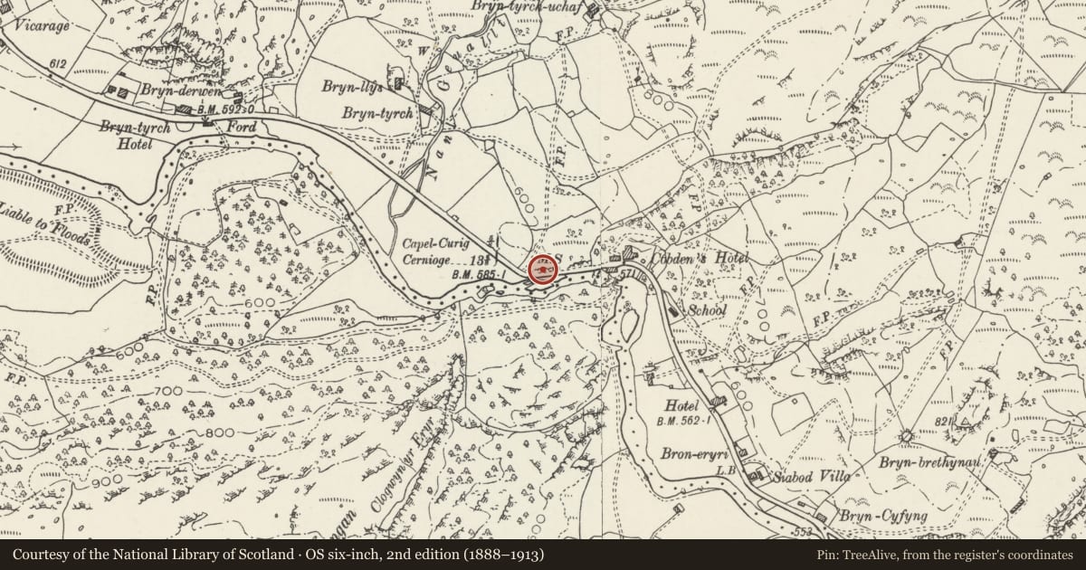
Slide toward Today to fade the historical sheet and see the modern map underneath.
David Rumsey Map Collection, Stanford LibrariesDavid Rumsey Map Collection, Stanford LibrariesDavid Rumsey Map Collection, Stanford LibrariesDavid Rumsey Map Collection, Stanford LibrariesLlyfrgell Genedlaethol Cymru – The National Library of Wales
5 historical maps cover this location, the earliest the 1795 map "To Sir Watkin Williams-Wynn Bart ... the map of the six counties of North Wales is most humbly inscribed by his obedient humble servant" (Llyfrgell Genedlaethol Cymru – The National Library of Wales).
Historical maps covering this location
- 1795 · To Sir Watkin Williams-Wynn Bart ... the map of the six counties of North Wales is most… (Llyfrgell Genedlaethol Cymru – The National Library of Wales)
- 1896 · Sheet 7. Ordnance Survey of England and Wales. (David Rumsey Map Collection, Stanford Libraries)
- 1899 · 106 Bangor (Outline) (David Rumsey Map Collection, Stanford Libraries)
- 1899 · 106 Bangor (Hills) (David Rumsey Map Collection, Stanford Libraries)
- 1901 · Sheet 9 and 10. (David Rumsey Map Collection, Stanford Libraries)
Cadw's description
Location
Situated on the roadside approximately .6km NW of Pont Cyfyng.
History
Following the Act of Union in 1801, a programme to improve the roads between the two capital cities of London and Dublin was initiated. In 1811 Thomas Telford was commissioned to undertake a survey of the roads between London and Holyhead and in 1817 began work on the northern stretch of the road at Shrewsbury. As well as overseeing the work, Thomas Telford also designed every detail of the road, and this milestone is one of a number designed for it. Milestones between Bangor and Cernioge were erected in the period between 1825 and February 1827.
Exterior
Dressed Anglesey limestone slab, with shallow triangular head and raking chamfered sides. Cast iron inset plate, white lettering on black reading: HOLY- / HEAD / 40 / C. CURIG / 5 Furlongs / CERNIOGE / 13M – 6F.
Has been relocated approximately 10m east of its original position.
Reason for designation
Listed as a fine example of one of Telford's milestones retaining its cast iron plate.
Nearby in the register
- Capel Curig cairnRound Cairnunder 1 mi
- Church of St CurigReligious, Ritual and Funeraryunder 1 mi
- Hen BontTransportunder 1 mi
- Church of St CurigReligious, Ritual and Funeraryunder 1 mi
Other entries of the same register within about three miles of this one, by straight line.