Cof Cymru: National Historic Assets of Wales · Wales
Cowshed at Gelli
Nantcwnlle, Ceredigion, Wales
A Grade II listed building in Trefilan, Lampeter, Nantcwnlle, Ceredigion, designated on 26 November 1996.
The record
- Designation
- Listed building, Grade II
- Broad class
- Agriculture and Subsistence
- Date of designation
- 26 November 1996
- Locality
- Trefilan
- Town
- Lampeter
- Community
- Nantcwnlle
- Unitary authority
- Ceredigion
- Country
- Wales
- Coordinates
- 52.19519, -4.12830
- Cadw reference
- 17809
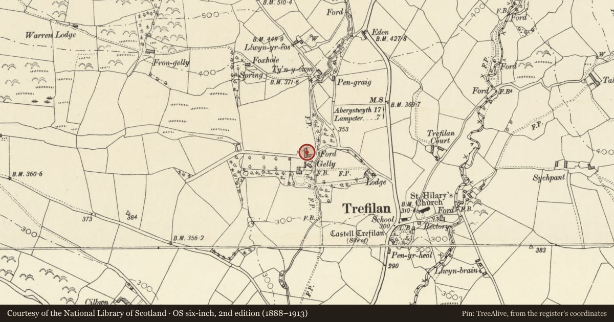
Slide toward Today to fade the historical sheet and see the modern map underneath.
David Rumsey Map Collection, Stanford LibrariesDavid Rumsey Map Collection, Stanford LibrariesDavid Rumsey Map Collection, Stanford LibrariesDavid Rumsey Map Collection, Stanford LibrariesDavid Rumsey Map Collection, Stanford Libraries
5 historical maps cover this location, the earliest the 1608 map "(13) Cambriae Typus." (David Rumsey Map Collection, Stanford Libraries).
Historical maps covering this location
- 1608 · (13) Cambriae Typus. (David Rumsey Map Collection, Stanford Libraries)
- 1830 · V.3:11-15:XV. Britisches Reich. A. Kon: England. b. Frstenthum Wales: Shire: 37-40 (David Rumsey Map Collection, Stanford Libraries)
- 1899 · 195 Lampeter (Hills) (David Rumsey Map Collection, Stanford Libraries)
- 1901 · Sheet 14. (David Rumsey Map Collection, Stanford Libraries)
- 1919 · Sheet 78. Lampeter. (David Rumsey Map Collection, Stanford Libraries)
Cadw's description
Location
Situated to N of Gelli walled garden, running N-S, and NW of other farm buildings.
History
Late C17 or early C18 outbuilding extended and remodelled as a cow-shed in the early to mid C19, with a coach-house added at S end.
Exterior
Whitewashed rubble stone with slate roof, single long range. Building slopes down from N to S. W side has, from left, door, ventilation loop, window, window, door roughly in centre. Then to right is one window in a blocked door. Timber lintels. N end has one window in former loading door. S end is added and has, in gable end, two large coach-entries with cambered timber lintels and squared stone centre and angle piers. Small lean-to on E side: S door, with stone voussoirs. Blocked door and door in main E wall.
Interior
In centre are three heavy oak roof trusses with scarfed feet and curved pegged collars. C19 pine collar trusses elsewhere. Two oak beams and stubs of third. In coach-house, dividing stone wall, and left coach-house has three-sided plaster ceiling, an unusual feature.
Reason for designation
Listed as an outbuilding range with early roof trusses, and of group value with the listed structures at Gelli.
Nearby in the register
- Outbuilding on N side of farmyard at GelliAgriculture and Subsistenceunder 1 mi
- Barn cottage at GelliAgriculture and Subsistenceunder 1 mi
- GelliDomesticunder 1 mi
- Walls of walled garden and lean-to at GelliDomesticunder 1 mi
Other entries of the same register within about three miles of this one, by straight line.