Cof Cymru: National Historic Assets of Wales · Wales
Talsarn Smithy
Nantcwnlle, Ceredigion, Wales
A Grade II listed building in Talsarn, Lampeter, Nantcwnlle, Ceredigion, designated on 26 November 1996.
The record
- Designation
- Listed building, Grade II
- Broad class
- Commercial
- Date of designation
- 26 November 1996
- Locality
- Talsarn
- Town
- Lampeter
- Community
- Nantcwnlle
- Unitary authority
- Ceredigion
- Country
- Wales
- Coordinates
- 52.18563, -4.12909
- Cadw reference
- 17803
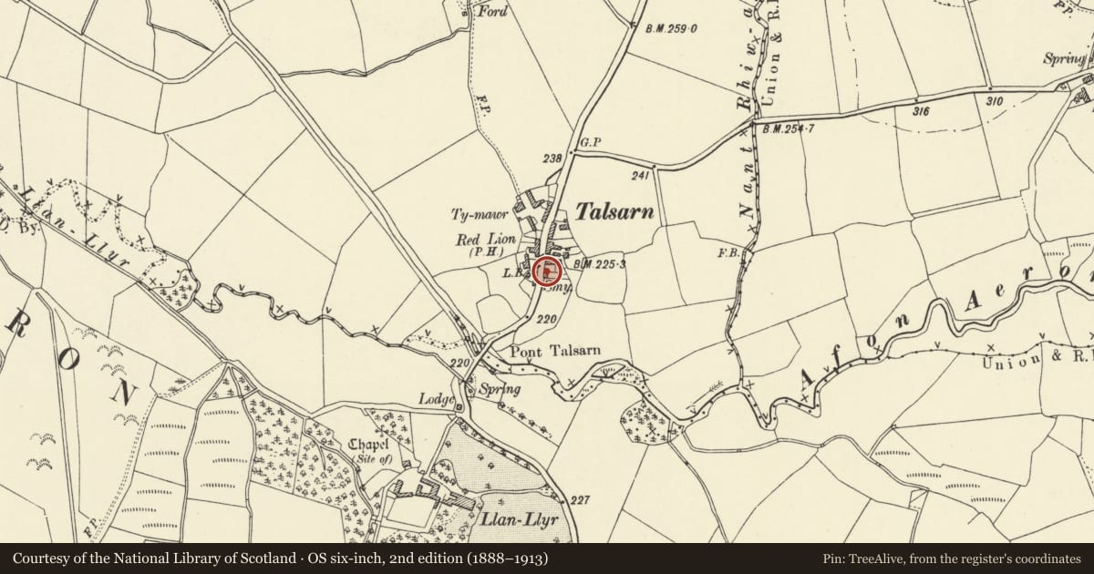
Slide toward Today to fade the historical sheet and see the modern map underneath.
David Rumsey Map Collection, Stanford LibrariesDavid Rumsey Map Collection, Stanford LibrariesDavid Rumsey Map Collection, Stanford LibrariesDavid Rumsey Map Collection, Stanford LibrariesDavid Rumsey Map Collection, Stanford Libraries
5 historical maps cover this location, the earliest the 1608 map "(13) Cambriae Typus." (David Rumsey Map Collection, Stanford Libraries).
Historical maps covering this location
- 1608 · (13) Cambriae Typus. (David Rumsey Map Collection, Stanford Libraries)
- 1830 · V.3:11-15:XV. Britisches Reich. A. Kon: England. b. Frstenthum Wales: Shire: 37-40 (David Rumsey Map Collection, Stanford Libraries)
- 1899 · 195 Lampeter (Hills) (David Rumsey Map Collection, Stanford Libraries)
- 1901 · Sheet 14. (David Rumsey Map Collection, Stanford Libraries)
- 1919 · Sheet 78. Lampeter. (David Rumsey Map Collection, Stanford Libraries)
Cadw's description
Location
Situated in Talsarn village, on E side of B 4337 nearly opposite Red Lion Inn.
History
Smithy on site said to be recorded from C16. Associated with Llanllyr mansion, Llanfihangel Ystrad. Probably rebuilt in early C19
Exterior
Squared rubble stone with asbestos sheet hipped roof. Single-storey, rectangular, with two small windows left and centre, each with stone voussoirs and casement pair windows, one glazed, one shuttered. To right, full height broad opening with C20 metal doors. Small stone stack on rear wall. C20 asbestos clad lean-to on N end. S end rubble stone with stone angle and centre piers, apparently an infilled two-bay opening.
Interior
Two rooms, S end divided off by rubble wall. Main N part is smithy with double hearth against rear walls, originally with two sets of bellows, those to left removed, but curved indent in wall to N marks position. Unusual cylindrical bellows to right. Additional hearth on S wall with bellows in SE corner. Smoke blackened collar-truss roof, bolted collars.
Reason for designation
Listed for its completeness as an early C19 rural smithy with internal fittings; still in use (1996).
Nearby in the register
- The Red Lion InnCommercialunder 1 mi
- Ty MawrDomesticunder 1 mi
- Pont Talsarn (partly in Nantcwnlle Community)Transportunder 1 mi
- Pont TalsarnTransportunder 1 mi
Other entries of the same register within about three miles of this one, by straight line.