Cof Cymru: National Historic Assets of Wales · Wales
Gate piers, gates and retaining walls to entrance to Plâs Dinam
Llandinam, Powys, Wales
A Grade II listed building in Llandinam, Powys, designated on 26 November 1996.
The record
- Designation
- Listed building, Grade II
- Broad class
- Domestic
- Date of designation
- 26 November 1996
- Locality
- Llandinam
- Community
- Llandinam
- Unitary authority
- Powys
- Country
- Wales
- Coordinates
- 52.49347, -3.43235
- Cadw reference
- 17773
Slide toward Today to fade the historical sheet and see the modern map underneath.
David Rumsey Map Collection, Stanford LibrariesDavid Rumsey Map Collection, Stanford LibrariesDavid Rumsey Map Collection, Stanford LibrariesDavid Rumsey Map Collection, Stanford LibrariesDavid Rumsey Map Collection, Stanford Libraries
5 historical maps cover this location, the earliest the 1608 map "(13) Cambriae Typus." (David Rumsey Map Collection, Stanford Libraries).
Historical maps covering this location
- 1608 · (13) Cambriae Typus. (David Rumsey Map Collection, Stanford Libraries)
- 1637 · Particular description of Wales. Cambria seu Wallia (David Rumsey Map Collection, Stanford Libraries)
- 1883 · Watershed map England, Wales 3. (David Rumsey Map Collection, Stanford Libraries)
- 1899 · 164 Llanidloes (Hills) (David Rumsey Map Collection, Stanford Libraries)
- 1901 · Sheet 14. (David Rumsey Map Collection, Stanford Libraries)
Cadw's description
Location
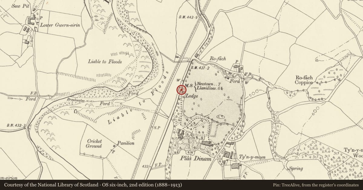
Located at the foot of the main driveway leading off the main Caersws to Llandinam road, approximately 1km N of the village centre.
Exterior
Built c.1875, probably to the design of W.E.Nesfield, to provide the main gated entrance to Plâs Dinam. The gate is set at right angles to the road to allow the driveway to turn to climb the bank to the mansion house. The piers are of limestone ashlar, channel rusticated and margin dressed, with hollow moulded corners and moulded gabled capitals. The gate is of timber, with square panels containing iron and timber tracery, and a band of turned balusters at the centre. One retaining wall extends from the right pier in a curve to face the main road, and extends 20m to another terminal pier, and from the left gate pier, parallel to the road before curving back to a terminal pier.
Reason for designation
Included as part of a group with the Lodge immediately within the gate, and an element of the total ensemble of Plâs Dinam.
Nearby in the register
- Lodge to Plâs DinamDomesticunder 1 mi
- Milestone opposite Lodge to Plâs DinamTransportunder 1 mi
- Plâs DinamDomesticunder 1 mi
- Llandinam Hall EnclosureEnclosureunder 1 mi
Other entries of the same register within about three miles of this one, by straight line.