Cof Cymru: National Historic Assets of Wales · Wales
Vestry and Coach-house to Capel Neuaddlwyd
Henfynyw, Ceredigion, Wales
A Grade II listed building in Neuadd-Lwyd, Henfynyw, Ceredigion, designated on 21 February 1996.
The record
- Designation
- Listed building, Grade II
- Broad class
- Domestic
- Date of designation
- 21 February 1996
- Locality
- Neuadd-Lwyd
- Community
- Henfynyw
- Unitary authority
- Ceredigion
- Country
- Wales
- Coordinates
- 52.21352, -4.23428
- Cadw reference
- 17756
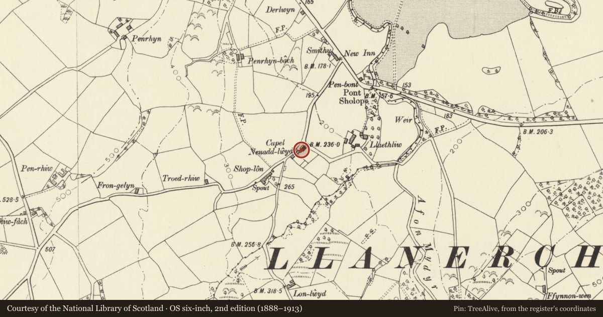
Slide toward Today to fade the historical sheet and see the modern map underneath.
David Rumsey Map Collection, Stanford LibrariesDavid Rumsey Map Collection, Stanford LibrariesDavid Rumsey Map Collection, Stanford LibrariesDavid Rumsey Map Collection, Stanford LibrariesDavid Rumsey Map Collection, Stanford Libraries
5 historical maps cover this location, the earliest the 1608 map "(13) Cambriae Typus." (David Rumsey Map Collection, Stanford Libraries).
Historical maps covering this location
- 1608 · (13) Cambriae Typus. (David Rumsey Map Collection, Stanford Libraries)
- 1830 · V.3:11-15:XV. Britisches Reich. A. Kon: England. b. Frstenthum Wales: Shire: 37-40 (David Rumsey Map Collection, Stanford Libraries)
- 1899 · 194 Llangranog (Hills) (David Rumsey Map Collection, Stanford Libraries)
- 1901 · Sheet 14. (David Rumsey Map Collection, Stanford Libraries)
- 1919 · Sheet 78. Lampeter. (David Rumsey Map Collection, Stanford Libraries)
Cadw's description
Location
Situated just W of Neuaddlwyd Independent chapel, in terraced row.
History
Mid C19 vestry or schoolroom above a stable and coach-house. Not marked on 1846 Tithe Map, apparently built as infill between chapel of 1816 (replaced 1906) and chapel house to right.
Exterior
Whitewashed rubble stone with slate roof. Two-storey, two-window range with red brick W end stack. Two 16-pane pivot windows under eaves to first floor with door to extreme right, against wall of adjoining house, reached by straight flight of slate-topped stone steps. Ground floor has pair of doors and small 6-pane window all under timber lintel to left and flat-headed coach-entry with stone voussoirs to right. Rubble stone rear wall with two similar 16-pane upper windows.
Reason for designation
Included for group value with attached chapel and terraced row to right, and as good example of a typical chapel outbuilding with minister's stable and coach-house below a `long room', used as Sunday School or vestry.
Nearby in the register
- Enclosure Railings to Capel NeuaddlwydReligious, Ritual and Funeraryunder 1 mi
- Ty CapelDomesticunder 1 mi
- Capel NeuaddlwydReligious, Ritual and Funeraryunder 1 mi
- Monument at Capel NeuaddlwydCommemorativeunder 1 mi
Other entries of the same register within about three miles of this one, by straight line.