Cof Cymru: National Historic Assets of Wales · Wales
Church House
Gresford, Wrexham, Wales
A Grade II listed building in Gresford, Wrexham, designated on 7 June 1963.
The record
- Designation
- Listed building, Grade II
- Broad class
- Domestic
- Date of designation
- 7 June 1963
- Locality
- Gresford
- Community
- Gresford
- Unitary authority
- Wrexham
- Country
- Wales
- Coordinates
- 53.08842, -2.97751
- Cadw reference
- 17660
Slide toward Today to fade the historical sheet and see the modern map underneath.
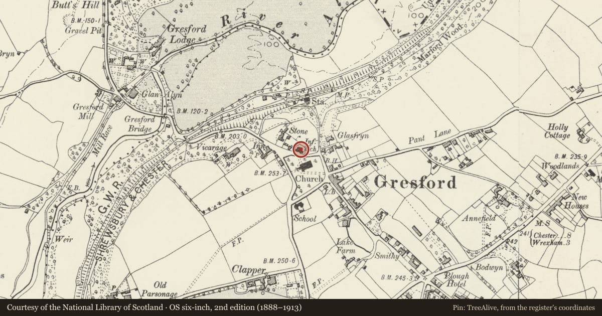
David Rumsey Map Collection, Stanford LibrariesDavid Rumsey Map Collection, Stanford LibrariesDavid Rumsey Map Collection, Stanford LibrariesDavid Rumsey Map Collection, Stanford LibrariesDavid Rumsey Map Collection, Stanford Libraries
5 historical maps cover this location, the earliest the 1608 map "(13) Cambriae Typus." (David Rumsey Map Collection, Stanford Libraries).
Historical maps covering this location
- 1608 · (13) Cambriae Typus. (David Rumsey Map Collection, Stanford Libraries)
- 1637 · Particular description of Wales. Cambria seu Wallia (David Rumsey Map Collection, Stanford Libraries)
- 1883 · Watershed map England, Wales 3. (David Rumsey Map Collection, Stanford Libraries)
- 1898 · 121 Wrexham (Hills) (David Rumsey Map Collection, Stanford Libraries)
- 1901 · Sheet 9 and 10. (David Rumsey Map Collection, Stanford Libraries)
Cadw's description
Location
Situated to the N of All Saints Church
History
Former school founded by Margaret Strode, daughter of Col. John Roberts of Gwersyllt; she left a bequest of £500 for the education of 3 poor boys and 3 poor girls. The building was erected in 1725 and an additional schoolroom was built to the rear in 1838 at a cost of £607 10s. C18 panelling which is said to have come from All Saints Church was used to make a dado in this room. The almshouses were also built in 1725 adjoining the school. They were built under the direction of Dr Robert Wynne chancellor of the diocese and vicar at Gresford for 53 years. The building is now 3 separate properties; the ranges at each end are private houses, that to the left probably extended, and the central section is used as church meeting rooms.
Interior
The schoolroom in the rear extension has an exposed timber roof and a dado formed from panelling of C18 character. remainder of interior not accessible at time of 1995 survey.
Reason for designation
Listed as an example of a C18 school and almshouses with original plaques recording the date of foundation. Group value with All Saints Church and with graveyard walls and gatepiers to All Saints Graveyard.
Nearby in the register
- Strode HouseDomesticunder 1 mi
- AchillDomesticunder 1 mi
- No 3 of 5 Graves in the Graveyard to NW of All Saints ChurchReligious, Ritual and Funeraryunder 1 mi
- No 1 of 5 Graves in the graveyard to NW of All Saints ChurchReligious, Ritual and Funeraryunder 1 mi
Other entries of the same register within about three miles of this one, by straight line.