Cof Cymru: National Historic Assets of Wales · Wales
Penrhyd Gatehouse
Eglwysbach, Conwy, Wales
A Grade II listed building in Tal-y-Cafn, Eglwysbach, Conwy, designated on 12 November 1996.
The record
- Designation
- Listed building, Grade II
- Broad class
- Domestic
- Date of designation
- 12 November 1996
- Locality
- Tal-y-Cafn
- Community
- Eglwysbach
- Unitary authority
- Conwy
- Country
- Wales
- Coordinates
- 53.23006, -3.81408
- Cadw reference
- 17571
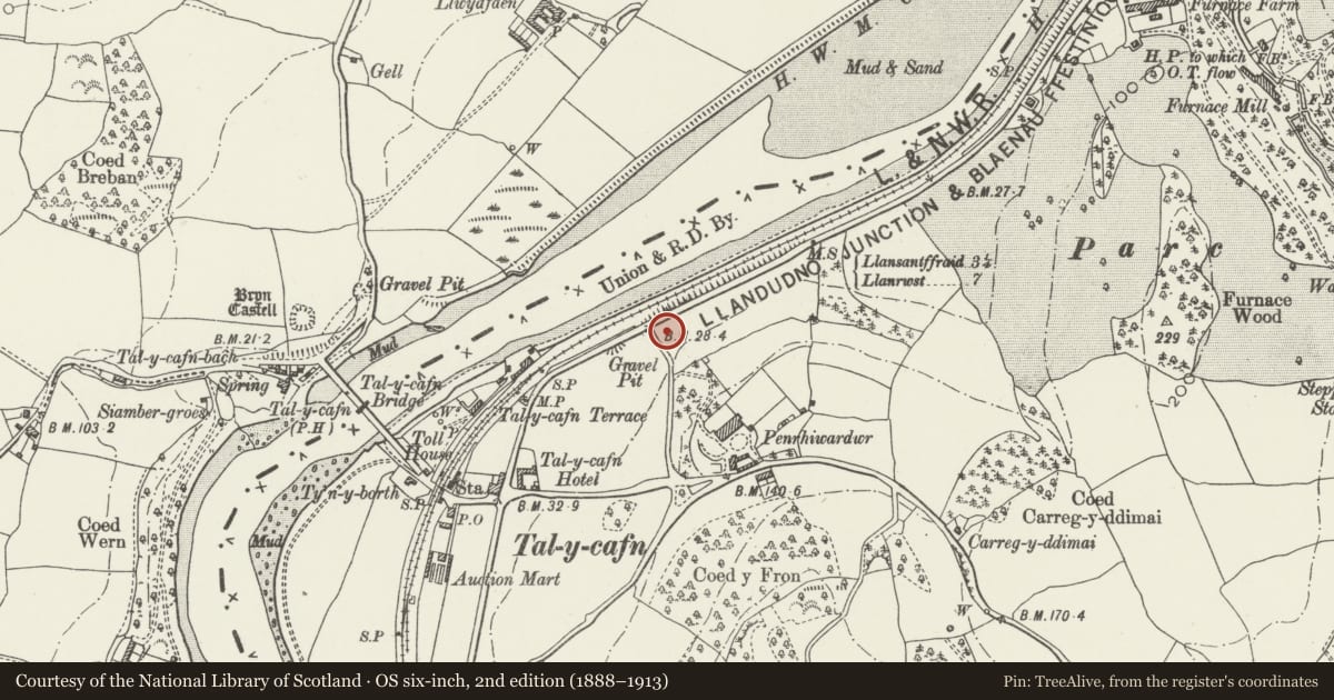
Slide toward Today to fade the historical sheet and see the modern map underneath.
David Rumsey Map Collection, Stanford LibrariesDavid Rumsey Map Collection, Stanford LibrariesDavid Rumsey Map Collection, Stanford LibrariesDavid Rumsey Map Collection, Stanford LibrariesLlyfrgell Genedlaethol Cymru – The National Library of Wales
5 historical maps cover this location, the earliest the 1795 map "To Sir Watkin Williams-Wynn Bart ... the map of the six counties of North Wales is most humbly inscribed by his obedient humble servant" (Llyfrgell Genedlaethol Cymru – The National Library of Wales).
Historical maps covering this location
- 1795 · To Sir Watkin Williams-Wynn Bart ... the map of the six counties of North Wales is most… (Llyfrgell Genedlaethol Cymru – The National Library of Wales)
- 1883 · Watershed map England, Wales 3. (David Rumsey Map Collection, Stanford Libraries)
- 1899 · 106 Bangor (Outline) (David Rumsey Map Collection, Stanford Libraries)
- 1899 · 106 Bangor (Hills) (David Rumsey Map Collection, Stanford Libraries)
- 1901 · Sheet 9 and 10. (David Rumsey Map Collection, Stanford Libraries)
Cadw's description
Location
Set back slightly on the SE side of the A 470, 250m E of Tal-y-Cafn.
Exterior
Small gate lodge to Penrhyd, designed in 1927 by Herbert Luck North, architect of Llanfairfechan in his characteristic Arts and Crafts style. Of roughcast rubble with long, sweeping slate roofs and brick dressings. Wide, gabled entrance section with large pointed arches above carriageway, springing from battered lower walls of snecked rubble; three courses of brown headers as voussoirs, with tiled label. Above, on both E and W faces, a 3-light leaded window with plain wooden mullions. To the R a semicircular projecting stair turret to the front, with conical roof and deep eaves; lead spike-finial. This has three vertical leaded lights to the upper section. This adjoins a single-storey cross-wing to the R which is built into a verge; 2 and 3-light windows as before and, to the R gable end, a modern semi-octagonal conservatory. 2 single lights at L, to the rear (E) face, as before, with stepped access up the verge to a modern door with modern window beyond. Within the main, arched gateway, round-arched entrances to N and S returns with modern panelled and part-leaded doors; three small leaded lights to N return. Contemporary white sloping, latticed iron gates to front (W).
Interior
The interior was not inspected at the time of survey ( May 1996).
Reason for designation
An unusual and inventive gate-lodge by an important Welsh Arts and Crafts architect.
Nearby in the register
- Bryn CastellMotteunder 1 mi
- Furnace MillIndustrialunder 1 mi
- The Pin MillIndustrialunder 1 mi
- The PoemCommemorativeunder 1 mi
Other entries of the same register within about three miles of this one, by straight line.