Cof Cymru: National Historic Assets of Wales · Wales
Entrance Gates at St Michael's Church
Ciliau Aeron, Ceredigion, Wales
A Grade II listed building in Ciliau Aeron, Ceredigion, designated on 23 May 1996.
The record
- Designation
- Listed building, Grade II
- Broad class
- Domestic
- Date of designation
- 23 May 1996
- Locality
- Ciliau Aeron
- Community
- Ciliau Aeron
- Unitary authority
- Ceredigion
- Country
- Wales
- Coordinates
- 52.20113, -4.19321
- Cadw reference
- 17518
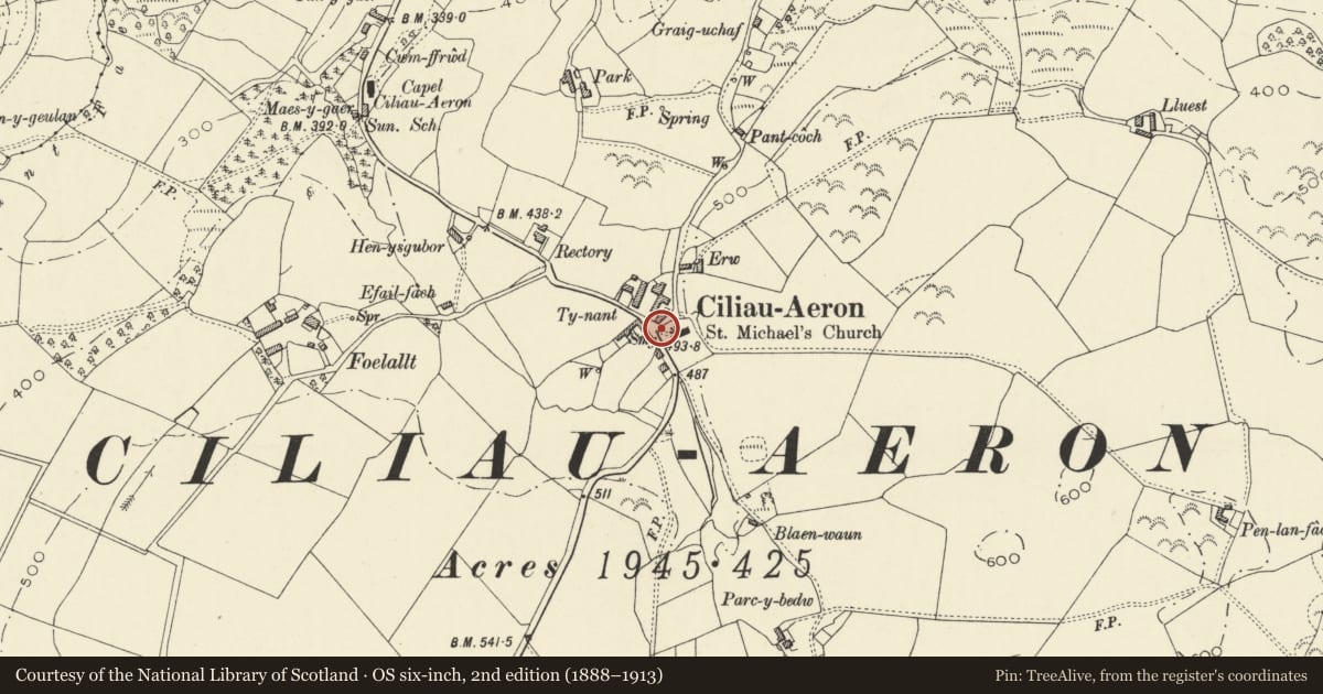
Slide toward Today to fade the historical sheet and see the modern map underneath.
David Rumsey Map Collection, Stanford LibrariesDavid Rumsey Map Collection, Stanford LibrariesDavid Rumsey Map Collection, Stanford LibrariesDavid Rumsey Map Collection, Stanford LibrariesDavid Rumsey Map Collection, Stanford Libraries
5 historical maps cover this location, the earliest the 1608 map "(13) Cambriae Typus." (David Rumsey Map Collection, Stanford Libraries).
Historical maps covering this location
- 1608 · (13) Cambriae Typus. (David Rumsey Map Collection, Stanford Libraries)
- 1830 · V.3:11-15:XV. Britisches Reich. A. Kon: England. b. Frstenthum Wales: Shire: 37-40 (David Rumsey Map Collection, Stanford Libraries)
- 1899 · 194 Llangranog (Hills) (David Rumsey Map Collection, Stanford Libraries)
- 1901 · Sheet 14. (David Rumsey Map Collection, Stanford Libraries)
- 1919 · Sheet 78. Lampeter. (David Rumsey Map Collection, Stanford Libraries)
Cadw's description
Location
Churchyard situated on N side of B4339 in small settlement, some 1.5km S of Ciliau Aeron. Gateway to NW corner of graveyard, with mounting-block immediately to W.
History
Probably early C19.
Exterior
Gate piers of squared rubble, stone tabling and peaked cemented rubble coping. Paired cast iron gates with arrow finials, dog-rail with similar finials: bracing above.
Large rectangular rubble built mounting-block. Hollow interior covered by a mixture of thick long stone slabs and thinner slate slabs. Two steps to N end.
Reason for designation
Gates and mounting-block contribute to attractive approach to rare mid C18 parish church. Group value.
Nearby in the register
- Mounting-Block at St Michael's ChurchDomesticunder 1 mi
- Railed Beynon Family Tomb Plus David Davies Tomb in St Michael's ChurchyardReligious, Ritual and Funeraryunder 1 mi
- Parish Church of St MichaelReligious, Ritual and Funeraryunder 1 mi
- Defended Enclosure 130m ENE of Capel Ciliau AeronEnclosureunder 1 mi
Other entries of the same register within about three miles of this one, by straight line.