Cof Cymru: National Historic Assets of Wales · Wales
One set of Gatepiers and Gates to drive SE of Llanerchaeron(Previously listed as sited at Llanaeron)
Ciliau Aeron, Ceredigion, Wales
A Grade II listed building in Llanerchaeron, Ciliau Aeron, Ceredigion, designated on 15 November 1990.
The record
- Designation
- Listed building, Grade II
- Broad class
- Domestic
- Date of designation
- 15 November 1990
- Locality
- Llanerchaeron
- Community
- Ciliau Aeron
- Unitary authority
- Ceredigion
- Country
- Wales
- Coordinates
- 52.21908, -4.22635
- Cadw reference
- 17515
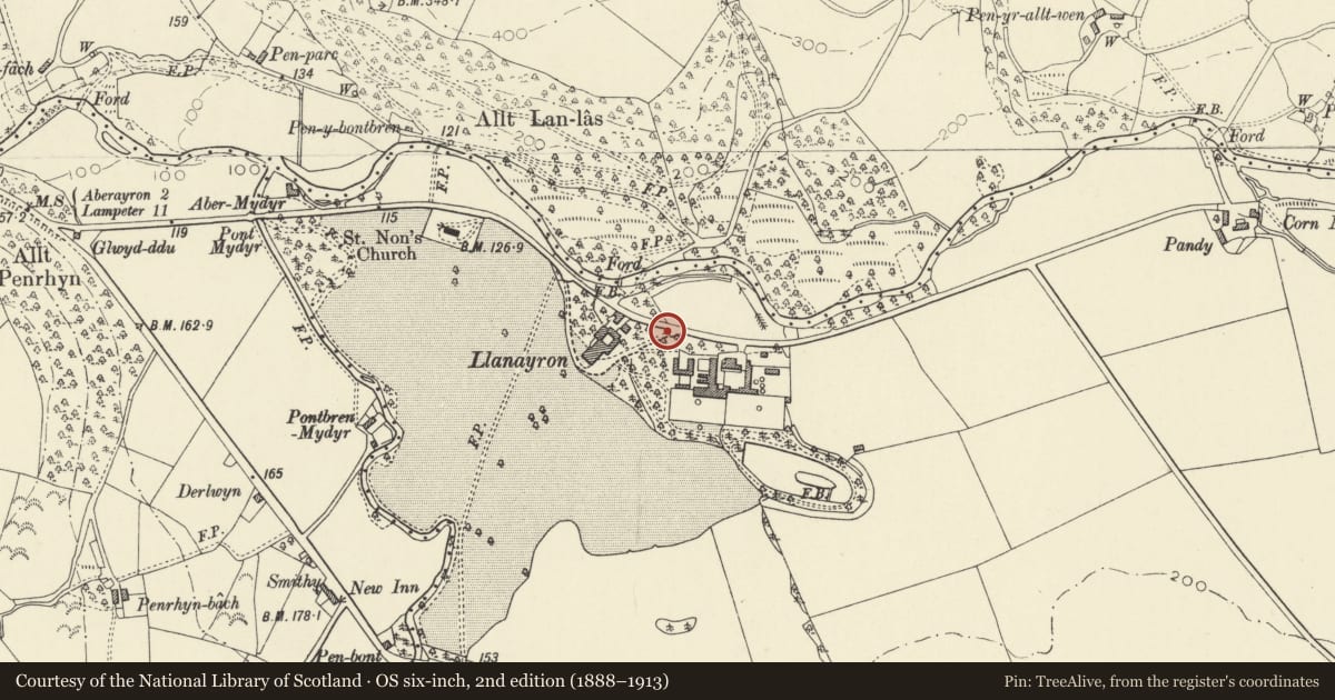
Slide toward Today to fade the historical sheet and see the modern map underneath.
David Rumsey Map Collection, Stanford LibrariesDavid Rumsey Map Collection, Stanford LibrariesDavid Rumsey Map Collection, Stanford LibrariesDavid Rumsey Map Collection, Stanford LibrariesDavid Rumsey Map Collection, Stanford Libraries
5 historical maps cover this location, the earliest the 1608 map "(13) Cambriae Typus." (David Rumsey Map Collection, Stanford Libraries).
Historical maps covering this location
- 1608 · (13) Cambriae Typus. (David Rumsey Map Collection, Stanford Libraries)
- 1830 · V.3:11-15:XV. Britisches Reich. A. Kon: England. b. Frstenthum Wales: Shire: 37-40 (David Rumsey Map Collection, Stanford Libraries)
- 1898 · 177 Aberaeron (Hills) (David Rumsey Map Collection, Stanford Libraries)
- 1901 · Sheet 14. (David Rumsey Map Collection, Stanford Libraries)
- 1919 · Sheet 78. Lampeter. (David Rumsey Map Collection, Stanford Libraries)
Cadw's description
Location
Situated at W and E entrances to driveway at Llanerchaeron, off by-road. One set some 100m N of the house, the other, some 100m E.
History
Erected c.1800, probably shortly after the 1794 remodelling of the house. Present driveways indicated on 1844 Tithe map.
Exterior
Two matching sets of four rubble stone piers with stepped coping. Low outer rubble walls with stone coping and spearhead iron railings between inner and outer piers. Central paired cast iron gates with top rails ramped down to centre. Spear finials: also to dograil, above band of circles.
Reason for designation
Group value with Llanerchaeron and other estate buildings.
Nearby in the register
- Billiard Room at Llanerchaeron (Previously listed as sited at Llanaeron House)Domesticunder 1 mi
- U-Plan Coach House and Stable Range at llanerchaeron(Previously listed as sited at Llanaeron House )Domesticunder 1 mi
- Outbuilding opposite Billiard Room at Llanerchaeron ( Previously listed as sited at Llanaeron HouseAgriculture and Subsistenceunder 1 mi
- N Range of attached outbuilding at Llanerchaeron (Previously listed as sited at Llanaeron House)Agriculture and Subsistenceunder 1 mi
Other entries of the same register within about three miles of this one, by straight line.