Cof Cymru: National Historic Assets of Wales · Wales
E range of farmyard at Monachty
Dyffryn Arth, Ceredigion, Wales
A Grade II listed building in Monachty/Mynachdy, Dyffryn Arth, Ceredigion, designated on 23 May 1996.
The record
- Designation
- Listed building, Grade II
- Broad class
- Agriculture and Subsistence
- Date of designation
- 23 May 1996
- Locality
- Monachty/Mynachdy
- Community
- Dyffryn Arth
- Unitary authority
- Ceredigion
- Country
- Wales
- Coordinates
- 52.23628, -4.19063
- Cadw reference
- 17492
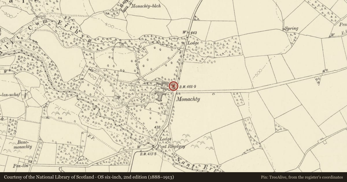
Slide toward Today to fade the historical sheet and see the modern map underneath.
David Rumsey Map Collection, Stanford LibrariesDavid Rumsey Map Collection, Stanford LibrariesDavid Rumsey Map Collection, Stanford LibrariesDavid Rumsey Map Collection, Stanford LibrariesDavid Rumsey Map Collection, Stanford Libraries
5 historical maps cover this location, the earliest the 1608 map "(13) Cambriae Typus." (David Rumsey Map Collection, Stanford Libraries).
Historical maps covering this location
- 1608 · (13) Cambriae Typus. (David Rumsey Map Collection, Stanford Libraries)
- 1830 · V.3:11-15:XV. Britisches Reich. A. Kon: England. b. Frstenthum Wales: Shire: 37-40 (David Rumsey Map Collection, Stanford Libraries)
- 1898 · 177 Aberaeron (Hills) (David Rumsey Map Collection, Stanford Libraries)
- 1901 · Sheet 14. (David Rumsey Map Collection, Stanford Libraries)
- 1919 · Sheet 78. Lampeter. (David Rumsey Map Collection, Stanford Libraries)
Cadw's description
Location
Situated parallel to road at E, entrance, end of yard.
Exterior
History: Mid C19 lofted outbuilding, perhaps a barn, the lean-to once housing an engine for turning shafts. Not marked on 1843 Tithe Map.
Exterior: Rubble stone with slate roofs. Tall lofted W front with broad cambered headed doorway flanked by large cross-windows. Stone voussoirs. Above door is slightly narrower large loft door with timber lintel under eaves. Big lean-to on S end with tall depressed arched opening, double doors and glazed big overlight. A similar door on rear E side, to road. Rear of main range has two ground floor windows, one now a door.
Attached to NE corner is cow-house range running W. This is listed separately.
Interior: Brick paved ground floor with raised platform at N end. Remains of shafting.
Group value with the rest of the exceptional group of farm buildings at Monachty.
Nearby in the register
- SE range of farm court at MonachtyAgriculture and Subsistenceunder 1 mi
- Covered Dung-pit in Monachty FarmyardAgriculture and Subsistenceunder 1 mi
- L-plan ranges on N and W sides of farmyard at MonachtyAgriculture and Subsistenceunder 1 mi
- Outbuilding on S side of farmyard at MonachtyAgriculture and Subsistenceunder 1 mi
Other entries of the same register within about three miles of this one, by straight line.