Cof Cymru: National Historic Assets of Wales · Wales
Former School by Church of St Padarn
Dyffryn Arth, Ceredigion, Wales
A Grade II listed building in Llanbadarn Trefeglwys, Dyffryn Arth, Ceredigion, designated on 23 May 1996.
The record
- Designation
- Listed building, Grade II
- Broad class
- Education
- Date of designation
- 23 May 1996
- Locality
- Llanbadarn Trefeglwys
- Community
- Dyffryn Arth
- Unitary authority
- Ceredigion
- Country
- Wales
- Coordinates
- 52.24683, -4.18650
- Cadw reference
- 17485
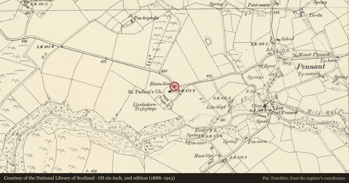
Slide toward Today to fade the historical sheet and see the modern map underneath.
David Rumsey Map Collection, Stanford LibrariesDavid Rumsey Map Collection, Stanford LibrariesDavid Rumsey Map Collection, Stanford LibrariesDavid Rumsey Map Collection, Stanford LibrariesDavid Rumsey Map Collection, Stanford Libraries
5 historical maps cover this location, the earliest the 1830 map "V.3:11-15:XV. Britisches Reich. A. Kon: England. b. Frstenthum Wales: Shire: 37-40" (David Rumsey Map Collection, Stanford Libraries).
Historical maps covering this location
- 1830 · V.3:11-15:XV. Britisches Reich. A. Kon: England. b. Frstenthum Wales: Shire: 37-40 (David Rumsey Map Collection, Stanford Libraries)
- 1848 · 57. Tregaron, SW Quad. (David Rumsey Map Collection, Stanford Libraries)
- 1896 · Sheet 7. Ordnance Survey of England and Wales. (David Rumsey Map Collection, Stanford Libraries)
- 1901 · Sheet 14. (David Rumsey Map Collection, Stanford Libraries)
- 1919 · Sheet 78. Lampeter. (David Rumsey Map Collection, Stanford Libraries)
Cadw's description
Location
Situated on NE edge of circular churchyard of Church of St Padarn, some 0.5 km W of Pennant.
Exterior
History: Small church schoolroom built in 1829 by Richard Rees of Llanbadarn, builder, for £33. Repairs were proposed in 1846.
Description: Unpainted cement render with slate roof and rendered stacks, one to W end, one on ridge at original E end. Single-storey, double-fronted original range with two small-paned sashes (boarded-over 1995) and centre door with plain Gothic arch. A one-window range added to E has one similar front window. Rubble stone NW rear wing, one broad full height entry and one door with stone voussoirs.
Included as a scarce surviving example of the small church schools of the earlier C19 in the region.
Reference: National Library of Wales Vestry Minutes.
Nearby in the register
- Capel PennantReligious, Ritual and Funeraryunder 1 mi
- Ty CapelReligious, Ritual and Funeraryunder 1 mi
- Pont PennantTransportunder 1 mi
- Llain including Outbuildings attached to gable endsDomesticunder 1 mi
Other entries of the same register within about three miles of this one, by straight line.