Cof Cymru: National Historic Assets of Wales · Wales
Alicia
Dyffryn Arth, Ceredigion, Wales
A Grade II listed building in Aberarth, Dyffryn Arth, Ceredigion, designated on 23 May 1996.
The record
- Designation
- Listed building, Grade II
- Broad class
- Domestic
- Date of designation
- 23 May 1996
- Locality
- Aberarth
- Community
- Dyffryn Arth
- Unitary authority
- Ceredigion
- Country
- Wales
- Coordinates
- 52.25094, -4.22871
- Cadw reference
- 17469
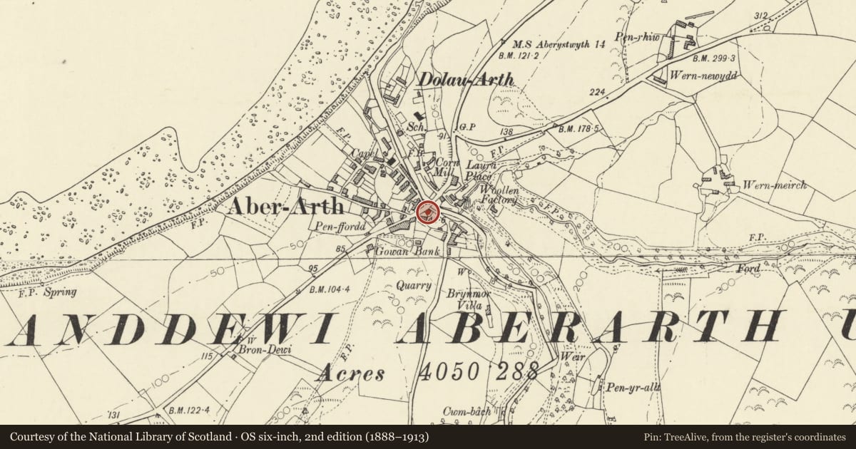
Slide toward Today to fade the historical sheet and see the modern map underneath.
David Rumsey Map Collection, Stanford LibrariesDavid Rumsey Map Collection, Stanford LibrariesDavid Rumsey Map Collection, Stanford LibrariesDavid Rumsey Map Collection, Stanford LibrariesDavid Rumsey Map Collection, Stanford Libraries
5 historical maps cover this location, the earliest the 1830 map "V.3:11-15:XV. Britisches Reich. A. Kon: England. b. Frstenthum Wales: Shire: 37-40" (David Rumsey Map Collection, Stanford Libraries).
Historical maps covering this location
- 1830 · V.3:11-15:XV. Britisches Reich. A. Kon: England. b. Frstenthum Wales: Shire: 37-40 (David Rumsey Map Collection, Stanford Libraries)
- 1896 · Sheet 7. Ordnance Survey of England and Wales. (David Rumsey Map Collection, Stanford Libraries)
- 1898 · 177 Aberaeron (Hills) (David Rumsey Map Collection, Stanford Libraries)
- 1901 · Sheet 14. (David Rumsey Map Collection, Stanford Libraries)
- 1919 · Sheet 78. Lampeter. (David Rumsey Map Collection, Stanford Libraries)
Cadw's description
Location
Situated just SW of Aberarth Bridge on S side of main road, A 487.
Exterior
History: Later C19 village house, possibly built by a returning sea-captain, the name reputedly that of a boat.
Description: Whitewashed stucco with slate hipped roof, crested ridge tiles and stone end stacks. Basement and two storeys, three-window range. 12-pane sashes, with narrower outer panes, 3-panel door with radiating-bar fanlight. Raised stucco quoins and surrounds with keystones, arched hoodmould over door. Rubble stone end walls and rear, the rear with three storeys.
Front garden enclosed by iron railings with fleur-de-lys heads on low rubble wall.
Included for its special character in a very prominent position in centre of Aberarth, close to Pont Aberarth and as a well-preserved mid/later C19 former sea-captains' house.
Nearby in the register
- Pont Aberarth and attached abutment wallsTransportunder 1 mi
- Telephone Call-box (01545 570241)Communicationsunder 1 mi
- DelfanDomesticunder 1 mi
- BryndewiDomesticunder 1 mi
Other entries of the same register within about three miles of this one, by straight line.