Cof Cymru: National Historic Assets of Wales · Wales
2 Yew Tree Cottages
Rossett, Wrexham, Wales
A Grade II listed building in Burton, Rossett, Wrexham, designated on 4 January 1991.
The record
- Designation
- Listed building, Grade II
- Broad class
- Domestic
- Date of designation
- 4 January 1991
- Locality
- Burton
- Community
- Rossett
- Unitary authority
- Wrexham
- Country
- Wales
- Coordinates
- 53.10567, -2.96806
- Cadw reference
- 17452
Slide toward Today to fade the historical sheet and see the modern map underneath.
David Rumsey Map Collection, Stanford LibrariesDavid Rumsey Map Collection, Stanford LibrariesDavid Rumsey Map Collection, Stanford LibrariesDavid Rumsey Map Collection, Stanford LibrariesDavid Rumsey Map Collection, Stanford Libraries
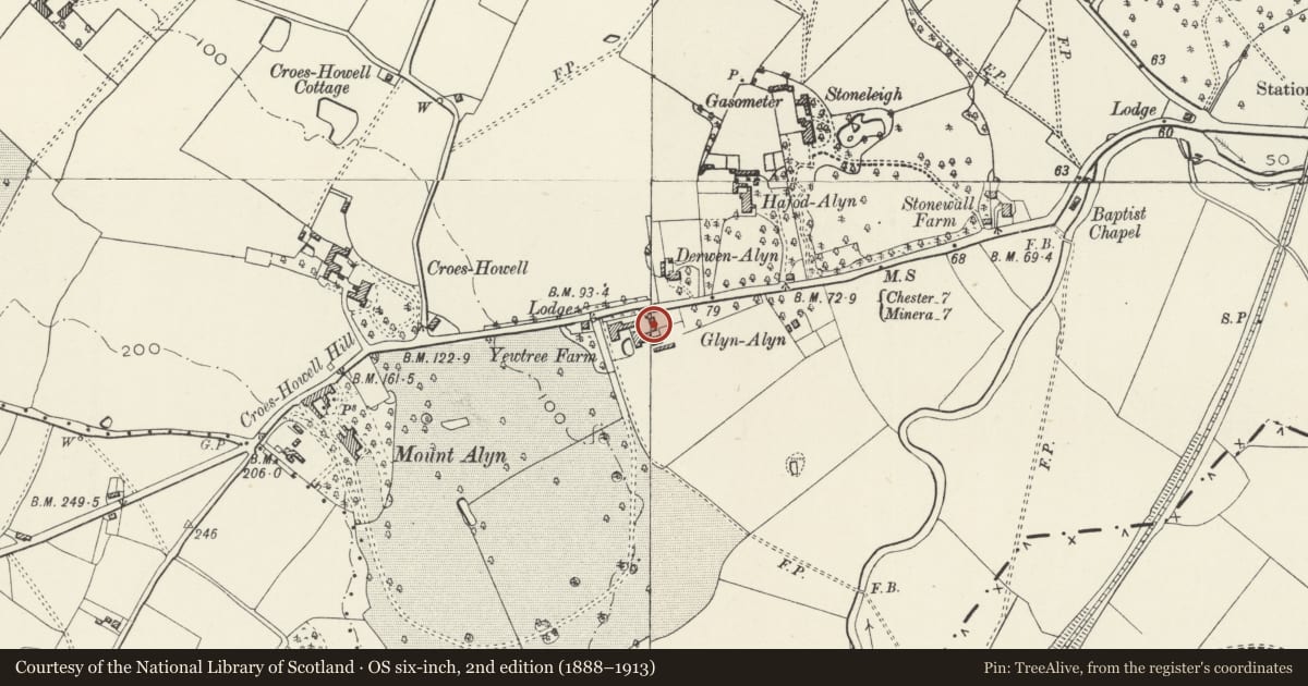
5 historical maps cover this location, the earliest the 1608 map "(13) Cambriae Typus." (David Rumsey Map Collection, Stanford Libraries).
Historical maps covering this location
- 1608 · (13) Cambriae Typus. (David Rumsey Map Collection, Stanford Libraries)
- 1637 · Particular description of Wales. Cambria seu Wallia (David Rumsey Map Collection, Stanford Libraries)
- 1883 · Watershed map England, Wales 3. (David Rumsey Map Collection, Stanford Libraries)
- 1898 · 108 Flint (Hills) (David Rumsey Map Collection, Stanford Libraries)
- 1901 · Sheet 9 and 10. (David Rumsey Map Collection, Stanford Libraries)
Cadw's description
Location
On south side of B 5102 Llay Road as it begins to ascend Croes Howell Hill. Approx. 1.2 km west of Rossett, at right angles to road.
History
Built in 1881 to the designs of John Douglas, architect, of Chester for Alexander Balfour who lived in nearby Mount Alyn (demolished). One cottage for farm bailiff, the other for use of members of a Liverpool mission. Uninhabited and boarded up at the time of re-survey (1995).
Interior
Internal inspection not possible at time of re-survey in November 1995.
Reason for designation
Included for group value with adjacent Outbuilding range at Yew Tree Farm.
Nearby in the register
- 1 Yew Tree CottagesDomesticunder 1 mi
- Outbuilding range immediately E of Yew Tree FarmAgriculture and Subsistenceunder 1 mi
- The Stone HouseDomesticunder 1 mi
- Mount Alyn Lodge (including gate piers at drive entrance)Domesticunder 1 mi
Other entries of the same register within about three miles of this one, by straight line.