Cof Cymru: National Historic Assets of Wales · Wales
Old Coach House
Lamphey, Pembrokeshire, Wales
A Grade II listed building in North Down, Lamphey, Pembrokeshire, designated on 30 April 1996.
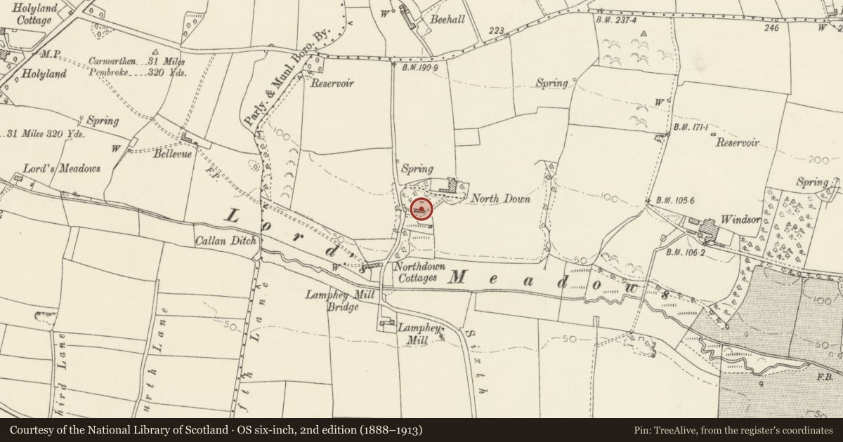
The record
- Designation
- Listed building, Grade II
- Broad class
- Domestic
- Date of designation
- 30 April 1996
- Locality
- North Down
- Community
- Lamphey
- Unitary authority
- Pembrokeshire
- Country
- Wales
- Coordinates
- 51.67595, -4.88326
- Cadw reference
- 17395
Slide toward Today to fade the historical sheet and see the modern map underneath.
David Rumsey Map Collection, Stanford LibrariesDavid Rumsey Map Collection, Stanford LibrariesDavid Rumsey Map Collection, Stanford LibrariesDavid Rumsey Map Collection, Stanford LibrariesDavid Rumsey Map Collection, Stanford Libraries
5 historical maps cover this location, the earliest the 1636 map "Cornubia : Devonia, Somersetus, Dorcestria, Wiltonia, Glocestria ..." (David Rumsey Map Collection, Stanford Libraries).
Historical maps covering this location
- 1636 · Cornubia : Devonia, Somersetus, Dorcestria, Wiltonia, Glocestria ... (David Rumsey Map Collection, Stanford Libraries)
- 1865 · England and Wales. England No. 6. (David Rumsey Map Collection, Stanford Libraries)
- 1891 · Sheet 10. Ordnance Survey of England and Wales. . (David Rumsey Map Collection, Stanford Libraries)
- 1898 · 245 Pembroke (Hills) (David Rumsey Map Collection, Stanford Libraries)
- 1901 · Sheet 13. (David Rumsey Map Collection, Stanford Libraries)
Cadw's description
Location
At S of North Down Farmhouse, reached by lane N of A4139 and W of Lamphey village.
Exterior
Early or mid C19 coach-house and stables facing S. In 1834 North Down was a 'genteel residence' owned by Col. Kemm and occupied by Rev. J B Byers (Vicar of Lamphey 1824-67), and the coach-house may be of about this date.
The building, in late Georgian style, has a pedimented central bay slightly advanced. Rendered rubble limestone generally with ashlar quoins and other dressings. Elliptical arch with keystone over central coach entrance. Originally a stable at the left and a stable and loose-box at the right. Flat arches with keystones to doors. Outer doors very high. Square openings to the loft are aligned above doors. Roundel in the pediment. A low-pitched roof, hipped at each end [sheeted]. Outside stairs at the E end.
Now converted to a milking parlour, with loss of internal walls and stalls.
Included as a well -designed late Georgian estate building, rare in South Pembrokeshire.
Reference: Lewis, Topographical Dictionary of Wales (1834)
Nearby in the register
- Milepost on A4075 opposite HolylandTransportunder 1 mi
- HolylandDomesticunder 1 mi
- Stable range at HolylandDomesticunder 1 mi
- Lamphey CourtDomesticunder 1 mi
Other entries of the same register within about three miles of this one, by straight line.