Cof Cymru: National Historic Assets of Wales · Wales
Pentre House
Churchstoke, Powys, Wales
A Grade II listed building in Pentre, Montgomery, Churchstoke, Powys, designated on 1 October 1996.
The record
- Designation
- Listed building, Grade II
- Broad class
- Domestic
- Date of designation
- 1 October 1996
- Locality
- Pentre
- Town
- Montgomery
- Community
- Churchstoke
- Unitary authority
- Powys
- Country
- Wales
- Coordinates
- 52.52184, -3.06365
- Cadw reference
- 17364
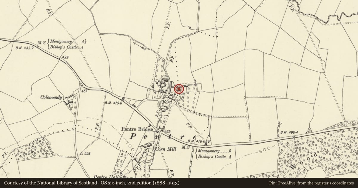
Slide toward Today to fade the historical sheet and see the modern map underneath.
David Rumsey Map Collection, Stanford LibrariesDavid Rumsey Map Collection, Stanford LibrariesDavid Rumsey Map Collection, Stanford LibrariesLlyfrgell Genedlaethol Cymru – The National Library of WalesDavid Rumsey Map Collection, Stanford Libraries
5 historical maps cover this location, the earliest the 1637 map "Particular description of Wales. Cambria seu Wallia" (David Rumsey Map Collection, Stanford Libraries).
Historical maps covering this location
- 1637 · Particular description of Wales. Cambria seu Wallia (David Rumsey Map Collection, Stanford Libraries)
- 1795 · To Sir Watkin Williams-Wynn Bart ... the map of the six counties of North Wales is most… (Llyfrgell Genedlaethol Cymru – The National Library of Wales)
- 1883 · Watershed map England, Wales 3. (David Rumsey Map Collection, Stanford Libraries)
- 1899 · 165 Montgomery (Hills) (David Rumsey Map Collection, Stanford Libraries)
- 1901 · Sheet 14. (David Rumsey Map Collection, Stanford Libraries)
Cadw's description
Location
Located in the hamlet of Pentre, to the N of the B4385, near Pentre Farm.
History
Gentrified front range of c 1800, possibly an addition to an earlier structure. Included on a plan of 1794, which showed land in the ownership of Sir Jukes Grenville Clifton Jukes.
Exterior
Well-detailed red brick front range with masonry range to rear which may be service area. 2 storeys. Slate roofs with broad overhanging eaves. 3-window front with projecting central bay. 9-pane sash windows to first floor and 12-pane sashes to ground floor, all under flat arched, finely gauged brick heads. Sandstone, Tuscan portico, comprising 4 columns and an entablature. Overlight above front door. 2 external stacks with paired, yellow brick shafts capped by sandstone blocks. Single storey, red brick range on W side with red brick end stack.
Interior
No access to the interior at time of inspection (May 1996).
Reason for designation
Listed as a fine well-detailed, gentrified house of c 1800 retaining its original character.
Nearby in the register
- Pentre MillIndustrialunder 1 mi
- Pentre HallDomesticunder 1 mi
- Pentre CampHillfortunder 1 mi
- MilestoneTransportunder 1 mi
Other entries of the same register within about three miles of this one, by straight line.