Cof Cymru: National Historic Assets of Wales · Wales
Cefn Maenllwyd
Kerry, Powys, Wales
A Grade II listed building in Maenllwyd, Newtown, Kerry, Powys, designated on 12 September 1996.
The record
- Designation
- Listed building, Grade II
- Broad class
- Domestic
- Date of designation
- 12 September 1996
- Locality
- Maenllwyd
- Town
- Newtown
- Community
- Kerry
- Unitary authority
- Powys
- Country
- Wales
- Coordinates
- 52.51749, -3.24629
- Cadw reference
- 17303
Slide toward Today to fade the historical sheet and see the modern map underneath.
David Rumsey Map Collection, Stanford LibrariesDavid Rumsey Map Collection, Stanford LibrariesDavid Rumsey Map Collection, Stanford LibrariesDavid Rumsey Map Collection, Stanford LibrariesLlyfrgell Genedlaethol Cymru – The National Library of Wales
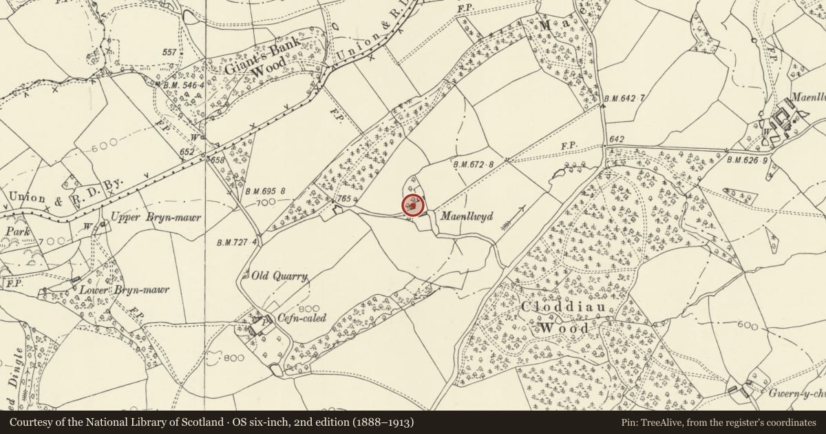
5 historical maps cover this location, the earliest the 1637 map "Particular description of Wales. Cambria seu Wallia" (David Rumsey Map Collection, Stanford Libraries).
Historical maps covering this location
- 1637 · Particular description of Wales. Cambria seu Wallia (David Rumsey Map Collection, Stanford Libraries)
- 1795 · To Sir Watkin Williams-Wynn Bart ... the map of the six counties of North Wales is most… (Llyfrgell Genedlaethol Cymru – The National Library of Wales)
- 1883 · Watershed map England, Wales 3. (David Rumsey Map Collection, Stanford Libraries)
- 1899 · 165 Montgomery (Hills) (David Rumsey Map Collection, Stanford Libraries)
- 1901 · Sheet 14. (David Rumsey Map Collection, Stanford Libraries)
Cadw's description
Location
The farmhouse lies behind the farm buildings, near the hilltop, at the end of a farm track off the NW side of the road from Kerry to Llanmerewig.
Exterior
Farmhouse of the C17, timber framed, now clad with sheet boarding and having a corrugated asbestos cement roof. Two bays, two storeys with attics, with a large external stone stack serving both bays. Brick outshut to rear. The gable end is twice jettied on cut brackets. Small paned timber windows. Roof has two tiers of purlins. Stack has stepped offsets, and an added brick flue.
Interior
Two unit plan, comprising a large kitchen with side stack, deeply chamfered ceiling beams forming 6 bays, and an inner parlour, sharing an extension of the stack, and two parallel ceiling beams.
Reason for designation
Include as an impressive example of a C17 farmhouse retaining its early character in later vernacular external cladding.
Nearby in the register
- Giant's Bank CampHillfortunder 1 mi
- Great Cloddiau CampEnclosureunder 1 mi
- Camp SW of Great Cloddiau Farm (revealed by aerial photography)Enclosureunder 1 mi
- The Old RectoryDomesticunder 1 mi
Other entries of the same register within about three miles of this one, by straight line.