Cof Cymru: National Historic Assets of Wales · Wales
Smithy at the corner of the Abermiwl and Churchstoke roads
Kerry, Powys, Wales
A Grade II listed building in Glan-Mule, Newtown, Kerry, Powys, designated on 12 September 1996.
The record
- Designation
- Listed building, Grade II
- Broad class
- Domestic
- Date of designation
- 12 September 1996
- Locality
- Glan-Mule
- Town
- Newtown
- Community
- Kerry
- Unitary authority
- Powys
- Country
- Wales
- Coordinates
- 52.50461, -3.23602
- Cadw reference
- 17296
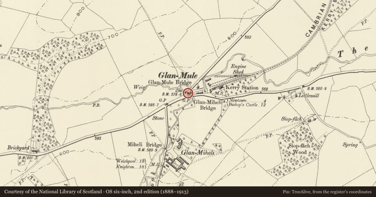
Slide toward Today to fade the historical sheet and see the modern map underneath.
David Rumsey Map Collection, Stanford LibrariesDavid Rumsey Map Collection, Stanford LibrariesDavid Rumsey Map Collection, Stanford LibrariesDavid Rumsey Map Collection, Stanford LibrariesDavid Rumsey Map Collection, Stanford Libraries
5 historical maps cover this location, the earliest the 1608 map "(13) Cambriae Typus." (David Rumsey Map Collection, Stanford Libraries).
Historical maps covering this location
- 1608 · (13) Cambriae Typus. (David Rumsey Map Collection, Stanford Libraries)
- 1637 · Particular description of Wales. Cambria seu Wallia (David Rumsey Map Collection, Stanford Libraries)
- 1883 · Watershed map England, Wales 3. (David Rumsey Map Collection, Stanford Libraries)
- 1899 · 165 Montgomery (Hills) (David Rumsey Map Collection, Stanford Libraries)
- 1901 · Sheet 14. (David Rumsey Map Collection, Stanford Libraries)
Cadw's description
Location
The house occupies the triangle of land between the two roads.
History
The house was built c1830-40 by J.W.Poundley as an estate cottage and smithy for the Brytnllywarch estate.
Exterior
Rubble with brick dressings, slate roofs. Cross plan, one storey and attic, gabled to each face with deep verges and highly fretted bargeboards terminating in apex and eaves spikes. Boarded door in the NE angle, under a lean-to roof. Two chamfered orders of brick forming pointed- headed window openings and containing small 24-pane windows, the glazing bars intersecting in the pointed heads. Central 8-flue linked octagonal stacks.
To the rear, the E wing is extended as a single-storey service range with a central brick stack.
Reason for designation
Included as a successful essay in the picturesque style, and indicative of the wide extent and power of the Brynllywarch estate at the time of the Naylors.
Nearby in the register
- Glan-Mule bridgeTransportunder 1 mi
- Site 450m NW of Glan Mule (revealed by aerial photography)Ring Ditchunder 1 mi
- Great Cloddiau CampEnclosureunder 1 mi
- Camp SW of Great Cloddiau Farm (revealed by aerial photography)Enclosureunder 1 mi
Other entries of the same register within about three miles of this one, by straight line.