Cof Cymru: National Historic Assets of Wales · Wales
Coachhouse at Dolforgan Hall
Kerry, Powys, Wales
A Grade II listed building in Dolforgan, Newtown, Kerry, Powys, designated on 12 September 1996.
The record
- Designation
- Listed building, Grade II
- Broad class
- Domestic
- Date of designation
- 12 September 1996
- Locality
- Dolforgan
- Town
- Newtown
- Community
- Kerry
- Unitary authority
- Powys
- Country
- Wales
- Coordinates
- 52.50378, -3.26465
- Cadw reference
- 17289
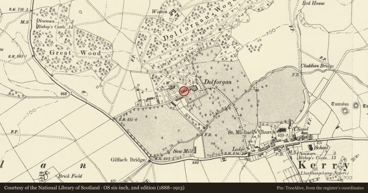
Slide toward Today to fade the historical sheet and see the modern map underneath.
David Rumsey Map Collection, Stanford LibrariesDavid Rumsey Map Collection, Stanford LibrariesDavid Rumsey Map Collection, Stanford LibrariesDavid Rumsey Map Collection, Stanford LibrariesDavid Rumsey Map Collection, Stanford Libraries
5 historical maps cover this location, the earliest the 1608 map "(13) Cambriae Typus." (David Rumsey Map Collection, Stanford Libraries).
Historical maps covering this location
- 1608 · (13) Cambriae Typus. (David Rumsey Map Collection, Stanford Libraries)
- 1637 · Particular description of Wales. Cambria seu Wallia (David Rumsey Map Collection, Stanford Libraries)
- 1883 · Watershed map England, Wales 3. (David Rumsey Map Collection, Stanford Libraries)
- 1899 · 165 Montgomery (Hills) (David Rumsey Map Collection, Stanford Libraries)
- 1901 · Sheet 14. (David Rumsey Map Collection, Stanford Libraries)
Cadw's description
Location
The coachhouse is located on the approach road to Dolforgan Hall from the E, and lies immediately W of the Hall itself.
Exterior
Rubble stone with slate roofs between raised gables. Probably early-mid C19 (not shown on the Inclosure Map of 1807), for the father of Lord Long. Symmetrical S front. Two gabled bays, set forward with one bay between, and with 2-bay single storey outer wings containing the carriage houses, each having 3-centred arched openings of ashlar stonework. The projecting bays, which are stone coped rising from kneelers, have similar arched openings on the ground floor, one blocked, the other replaced, and C20 windows on the upper floor within the original openings. Stack placed symmetrically on the rear slope. The carriage houses retain the original boarded doors. Central block, probably originally with groom's dwelling, is now a separate dwelling, with an open lean-to at the front.
Reason for designation
Included as an estate building retaining its original form, and forming a group with Dolforgan Hall.
Nearby in the register
- Dolforgan HallDomesticunder 1 mi
- Fountain in S garden at Dolforgen HallGardens, Parks and Urban Spacesunder 1 mi
- Driveway bridge over Afon MiwlTransportunder 1 mi
- Dolforgan sawmillIndustrialunder 1 mi
Other entries of the same register within about three miles of this one, by straight line.