Cof Cymru: National Historic Assets of Wales · Wales
Limekiln
Cosheston, Pembrokeshire, Wales
A Grade II listed building in Jenkins Point, Pembroke Dock, Cosheston, Pembrokeshire, designated on 12 September 1996.
The record
- Designation
- Listed building, Grade II
- Broad class
- Industrial
- Date of designation
- 12 September 1996
- Locality
- Jenkins Point
- Town
- Pembroke Dock
- Community
- Cosheston
- Unitary authority
- Pembrokeshire
- Country
- Wales
- Coordinates
- 51.71591, -4.88458
- Cadw reference
- 17269
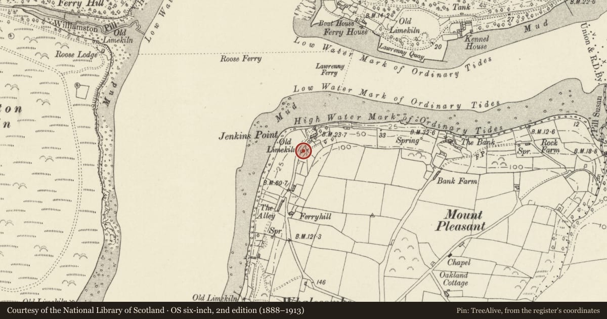
Slide toward Today to fade the historical sheet and see the modern map underneath.
David Rumsey Map Collection, Stanford LibrariesDavid Rumsey Map Collection, Stanford LibrariesDavid Rumsey Map Collection, Stanford LibrariesDavid Rumsey Map Collection, Stanford LibrariesDavid Rumsey Map Collection, Stanford Libraries
5 historical maps cover this location, the earliest the 1636 map "Cornubia : Devonia, Somersetus, Dorcestria, Wiltonia, Glocestria ..." (David Rumsey Map Collection, Stanford Libraries).
Historical maps covering this location
- 1636 · Cornubia : Devonia, Somersetus, Dorcestria, Wiltonia, Glocestria ... (David Rumsey Map Collection, Stanford Libraries)
- 1865 · England and Wales. England No. 6. (David Rumsey Map Collection, Stanford Libraries)
- 1891 · Sheet 10. Ordnance Survey of England and Wales. . (David Rumsey Map Collection, Stanford Libraries)
- 1898 · 228 Haverfordwest (Hills) (David Rumsey Map Collection, Stanford Libraries)
- 1901 · Sheet 13. (David Rumsey Map Collection, Stanford Libraries)
Cadw's description
Location
About 2 km N of Cosheston Village, at the right side of the road approaching Ferry House and about 100 m from the shore of the estuary.
History
A kiln of mid-C19 date intended for burning limestone brought ashore via Jenkins Point. Probably post-1840, as it is not marked on the Tithe Survey.
Exterior
A well-preserved small limekiln about 5.5 m in diameter externally and about 3.5 m high, standing beside the road on the W side. A ramp leads up from the roadside at the N, and the bank behind the ramp is revetted. The kiln has opposed openings at the N and S, with neatly corbelled archways. The archway at the N is capped with a short lintel, the archway at the S lacks its lintel but is otherwise complete. Neatly formed curved retaining wing walls at N and S.
Interior
The interior diameter of the kiln is about 3 m and there does not appear to have been any firebrick lining.
Reason for designation
Listed as a particularly well-preserved small mid-C19 limekilne.
Nearby in the register
- Lawrenny QuayTransportunder 1 mi
- Benton CastleDomesticunder 1 mi
- Church of St CaradocReligious, Ritual and Funeraryunder 1 mi
- St Caradoc Churchyard GatewayReligious, Ritual and Funeraryunder 1 mi
Other entries of the same register within about three miles of this one, by straight line.