Cof Cymru: National Historic Assets of Wales · Wales
Former School House to Old Grammer School
Ruabon, Wrexham, Wales
A Grade II listed building in Ruabon, Wrexham, designated on 14 May 1988.
The record
- Designation
- Listed building, Grade II
- Broad class
- Education
- Date of designation
- 14 May 1988
- Locality
- Ruabon
- Community
- Ruabon
- Unitary authority
- Wrexham
- Country
- Wales
- Coordinates
- 52.98713, -3.04055
- Cadw reference
- 1724
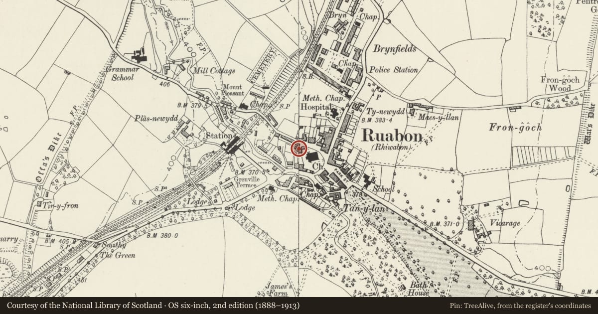
Slide toward Today to fade the historical sheet and see the modern map underneath.
David Rumsey Map Collection, Stanford LibrariesDavid Rumsey Map Collection, Stanford LibrariesDavid Rumsey Map Collection, Stanford LibrariesDavid Rumsey Map Collection, Stanford LibrariesLlyfrgell Genedlaethol Cymru – The National Library of Wales
5 historical maps cover this location, the earliest the 1795 map "To Sir Watkin Williams-Wynn Bart ... the map of the six counties of North Wales is most humbly inscribed by his obedient humble servant" (Llyfrgell Genedlaethol Cymru – The National Library of Wales).
Historical maps covering this location
- 1795 · To Sir Watkin Williams-Wynn Bart ... the map of the six counties of North Wales is most… (Llyfrgell Genedlaethol Cymru – The National Library of Wales)
- 1883 · Watershed map England, Wales 3. (David Rumsey Map Collection, Stanford Libraries)
- 1898 · 121 Wrexham (Hills) (David Rumsey Map Collection, Stanford Libraries)
- 1898 · 121 Wrexham (Outline) (David Rumsey Map Collection, Stanford Libraries)
- 1901 · Sheet 9 and 10. (David Rumsey Map Collection, Stanford Libraries)
Cadw's description
Location
At NW angle of St Mary's churchyard and stepped downhill from W gable of the Old Grammar School.
History
The Charity Commissioners noted in 1837 that the schoolmaster had built a kitchen and brewhouse, with two rooms over, in 1825. The building was being converted for residential use at the time of survey (October 1994).
Exterior
Sandstone rubble with squared quoins, hipped slate roof: 2-storey 2 windows. Upper floor has one multipaned cast-iron window with intersecting Gothick heads, and a multipaned cast-iron casement below. Other windows removed or blocked. Door to right hand side of later date.
Interior
Few interior features appear to survive and the division between rooms at upper floor level no longer exists.
Reason for designation
Listed as an early C19 building with historical associations with the Old Grammar School.
Group value with the Old Grammar School.
Nearby in the register
- The Old Grammar SchoolEducationunder 1 mi
- Hearse ShedAgriculture and Subsistenceunder 1 mi
- StonehurstDomesticunder 1 mi
- Spring Lodge (including Forecourt Walls and Railings)Commercialunder 1 mi
Other entries of the same register within about three miles of this one, by straight line.