Cof Cymru: National Historic Assets of Wales · Wales
Gate piers, gates and screen to the E drive of Maesllwch Castle
Glasbury, Powys, Wales
A Grade II listed building in Maesllwch, Glasbury, Powys, designated on 18 January 1996.
The record
- Designation
- Listed building, Grade II
- Broad class
- Domestic
- Date of designation
- 18 January 1996
- Locality
- Maesllwch
- Community
- Glasbury
- Unitary authority
- Powys
- Country
- Wales
- Coordinates
- 52.05694, -3.19806
- Cadw reference
- 17218
Slide toward Today to fade the historical sheet and see the modern map underneath.
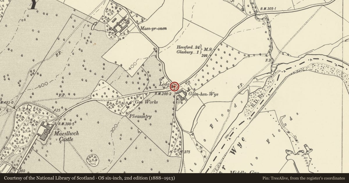
David Rumsey Map Collection, Stanford LibrariesDavid Rumsey Map Collection, Stanford LibrariesDavid Rumsey Map Collection, Stanford LibrariesDavid Rumsey Map Collection, Stanford LibrariesDavid Rumsey Map Collection, Stanford Libraries
5 historical maps cover this location, the earliest the 1608 map "(13) Cambriae Typus." (David Rumsey Map Collection, Stanford Libraries).
Historical maps covering this location
- 1608 · (13) Cambriae Typus. (David Rumsey Map Collection, Stanford Libraries)
- 1636 · Cornubia : Devonia, Somersetus, Dorcestria, Wiltonia, Glocestria ... (David Rumsey Map Collection, Stanford Libraries)
- 1637 · Particular description of Wales. Cambria seu Wallia (David Rumsey Map Collection, Stanford Libraries)
- 1856 · 42. Brecon. (David Rumsey Map Collection, Stanford Libraries)
- 1901 · Sheet 14. (David Rumsey Map Collection, Stanford Libraries)
Cadw's description
Location
Located at a bend of the minor road leading off the Brecon to Hereford Road to Ffynnon Gynnydd.
Exterior
Built c.1830-40 by Robert Lugar in connection with his rebuilding of Maesllwch Castle for Walter Wilkins. The screen comprises central gatepiers, with iron railings on a low stone wall on either side, ending in terminal piers, the right side curved back to follow the road.
Gatepiers are of sandstone, octagonal, approximately 3.5m high, each with moulded base, all facets having cinquefoiled headed recessed panels, and moulded capital. The low walls are of rock-faced stone with weathered copings. carrying cast-iron railings having fleur-de-lys terminals, supported by similar stanchions with scrolled brackets to the rear. The rails rise to meet the central gatepiers. The terminal piers are also rock-faced, with chamfered corners, necking and moulded capitals.
The gates have double central rail, dog rails below and the rails arched below the top rail. Fleur-de-lys terminals.
Reason for designation
Of group value with the East Lodge, and part of the designed scheme for the rebuilding of the Grade II castle.
Nearby in the register
- East Lodge to Maesllwch CastleDomesticunder 1 mi
- Stables and Coachhouse at Glan Hen WyeDomesticunder 1 mi
- Glan Hen WyeDomesticunder 1 mi
- MilestoneTransportunder 1 mi
Other entries of the same register within about three miles of this one, by straight line.