Cof Cymru: National Historic Assets of Wales · Wales
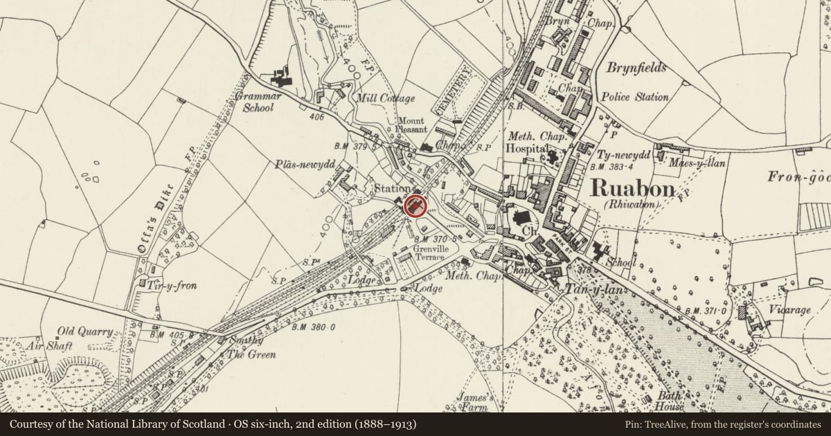
Ruabon Railway Station
Ruabon, Wrexham, Wales
A Grade II listed building in Ruabon, Wrexham, designated on 24 February 1983.
The record
- Designation
- Listed building, Grade II
- Broad class
- Transport
- Date of designation
- 24 February 1983
- Locality
- Ruabon
- Community
- Ruabon
- Unitary authority
- Wrexham
- Country
- Wales
- Coordinates
- 52.98713, -3.04327
- Cadw reference
- 1719
Slide toward Today to fade the historical sheet and see the modern map underneath.
David Rumsey Map Collection, Stanford LibrariesDavid Rumsey Map Collection, Stanford LibrariesDavid Rumsey Map Collection, Stanford LibrariesDavid Rumsey Map Collection, Stanford LibrariesLlyfrgell Genedlaethol Cymru – The National Library of Wales
5 historical maps cover this location, the earliest the 1795 map "To Sir Watkin Williams-Wynn Bart ... the map of the six counties of North Wales is most humbly inscribed by his obedient humble servant" (Llyfrgell Genedlaethol Cymru – The National Library of Wales).
Historical maps covering this location
- 1795 · To Sir Watkin Williams-Wynn Bart ... the map of the six counties of North Wales is most… (Llyfrgell Genedlaethol Cymru – The National Library of Wales)
- 1883 · Watershed map England, Wales 3. (David Rumsey Map Collection, Stanford Libraries)
- 1898 · 121 Wrexham (Hills) (David Rumsey Map Collection, Stanford Libraries)
- 1898 · 121 Wrexham (Outline) (David Rumsey Map Collection, Stanford Libraries)
- 1901 · Sheet 9 and 10. (David Rumsey Map Collection, Stanford Libraries)
Cadw's description
Location
Situated off Bridge Street to the W of the town centre.
History
Designed by Henry Robertson in the 1860s replacing the original Shrewsbury and Chester Railway Station by T M Penson. Converted to offices late C20 and platform canopy removed.
Exterior
Tudor-Gothic Revival style, single storey. Sandstone ashlar with rusticated quoins, slate roof, stone chimneys. Elevation to road: projecting gabled wings to each end with stone copings and finials. Each has a tall mullioned and transomed window, partially blocked. Central range has central mullioned and transomed window, and a doorway on each side with Tudor-arch head and dimpled spandrels. Low ranges with end stack set back and attached to left and right. Similar platform elevation: low flanking ranges have blocked entrances and windows, other openings blocked, cast-iron gutter with shaped brackets and cast-iron rainwater goods.
Reason for designation
Listed for its special interest as good example of an 1860s station in a style popular for rural railway architecture.
Nearby in the register
- Congregational Church (including attached Sunday School, gatepiers, walls and railings)Religious, Ritual and Funeraryunder 1 mi
- AlmshouseHealth and Welfareunder 1 mi
- AlmhouseHealth and Welfareunder 1 mi
- AlmhouseHealth and Welfareunder 1 mi
Other entries of the same register within about three miles of this one, by straight line.