Cof Cymru: National Historic Assets of Wales · Wales
Toll Cottage at Boughrood Bridge
Glasbury, Powys, Wales
A Grade II listed building in Boughrood, Glasbury, Powys, designated on 18 January 1996.
The record
- Designation
- Listed building, Grade II
- Broad class
- Commercial
- Date of designation
- 18 January 1996
- Locality
- Boughrood
- Community
- Glasbury
- Unitary authority
- Powys
- Country
- Wales
- Coordinates
- 52.03791, -3.26919
- Cadw reference
- 17189
Slide toward Today to fade the historical sheet and see the modern map underneath.
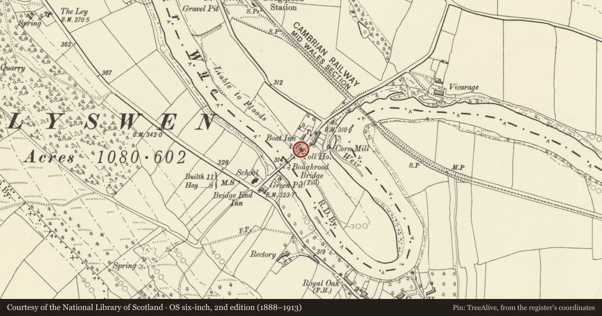
David Rumsey Map Collection, Stanford LibrariesDavid Rumsey Map Collection, Stanford LibrariesDavid Rumsey Map Collection, Stanford LibrariesDavid Rumsey Map Collection, Stanford LibrariesDavid Rumsey Map Collection, Stanford Libraries
5 historical maps cover this location, the earliest the 1608 map "(13) Cambriae Typus." (David Rumsey Map Collection, Stanford Libraries).
Historical maps covering this location
- 1608 · (13) Cambriae Typus. (David Rumsey Map Collection, Stanford Libraries)
- 1636 · Cornubia : Devonia, Somersetus, Dorcestria, Wiltonia, Glocestria ... (David Rumsey Map Collection, Stanford Libraries)
- 1856 · 42. Brecon. (David Rumsey Map Collection, Stanford Libraries)
- 1896 · 214 Talgarth (Hills) (David Rumsey Map Collection, Stanford Libraries)
- 1901 · Sheet 14. (David Rumsey Map Collection, Stanford Libraries)
Cadw's description
Location
Located on the SE side of Boughrood Bridge, at the Radnorshire end of the crossing to Brecknockshire
History
The Toll house was added to Boughrood Bridge in 1843 by T.H.Wyatt and D.Brandon, for the Maesllwch Estate. It was occupied in the 1851 census by John and Elizabeth Meredith, cobblers.
Exterior
Coursed rubble with slate roof. Two storeys the upper being at the level of the bridge. Lower floor consisted of a living room, entered through a kitchen, having a fireplace on the back wall, and a stair to the upper room, which had an open fronted lobby on to the road and an inner room, the lobby now enclosed with a simple door to the road. Small round headed windows, triple to the SW elevation, double to the smaller rooms, and from the lobby overlooking the approaching road. Stack on rear wall. Wide eaves with boarded soffit and bargeboards.
Reason for designation
Included as an unusual example of a bridge tollhouse erected privately in the mid C19.
Nearby in the register
- Boughrood BridgeTransportunder 1 mi
- Griffin InnCommercialunder 1 mi
- Church of St. GwendolineReligious, Ritual and Funeraryunder 1 mi
- Boughrood CastleDomesticunder 1 mi
Other entries of the same register within about three miles of this one, by straight line.