Cof Cymru: National Historic Assets of Wales · Wales
Lookout Tower
Angle, Pembrokeshire, Wales
A Grade II listed building in Hardings Hill, Angle, Pembrokeshire, designated on 26 January 1996.
The record
- Designation
- Listed building, Grade II
- Broad class
- Maritime
- Date of designation
- 26 January 1996
- Locality
- Hardings Hill
- Community
- Angle
- Unitary authority
- Pembrokeshire
- Country
- Wales
- Coordinates
- 51.67042, -5.06846
- Cadw reference
- 17167
Slide toward Today to fade the historical sheet and see the modern map underneath.
David Rumsey Map Collection, Stanford LibrariesDavid Rumsey Map Collection, Stanford LibrariesDavid Rumsey Map Collection, Stanford LibrariesDavid Rumsey Map Collection, Stanford LibrariesDavid Rumsey Map Collection, Stanford Libraries
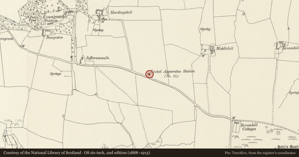
5 historical maps cover this location, the earliest the 1608 map "(13) Cambriae Typus." (David Rumsey Map Collection, Stanford Libraries).
Historical maps covering this location
- 1608 · (13) Cambriae Typus. (David Rumsey Map Collection, Stanford Libraries)
- 1636 · Cornubia : Devonia, Somersetus, Dorcestria, Wiltonia, Glocestria ... (David Rumsey Map Collection, Stanford Libraries)
- 1865 · England and Wales. England No. 6. (David Rumsey Map Collection, Stanford Libraries)
- 1898 · 244 Linney Head (Hills) (David Rumsey Map Collection, Stanford Libraries)
- 1901 · Sheet 13. (David Rumsey Map Collection, Stanford Libraries)
Cadw's description
Location
At N side of B4320 road.
History
Built at the end of the C19, the Rocket Cart House (Board of Trade Rocket Apparatus Station no. 11) was the base for the cliff-rescue team with rockets, lines and breeches-buoys. It was in use until the 1930s, with a team of about 20 rescuers. In about 1970 it was taken as a holiday house and underwent minor alterations. It consists of a cart house originally with double-doors and a three-storey look-out tower. The whole site is at the N of the road, raised about 0.5 m above the adjacent field level and enclosed on three sides by a red brick wall about 1 m high. At front is a stone-block paved hardstanding area.
Exterior
Tower, attached to house at E: Three storeys. Plinth about 0.5 m high. Originally facing-brickwork, now rendered in rough texture. Brick corbels and dentil course and parapet, also rendered. Ground storey: replaced door faces the front. First storey, facing S and N: pair of round-headed windows on a common sill with three sub-sill brackets. Second storey, facing W, N and S: triplet of similar windows on a common sill with four brackets. Flat roof.
Enclosure wall: original red-brick wall in Flemish Bond, local bricks.
Reason for designation
Listed as a very prominent local landmark on a raised vantage point and as a significant monument to the Coastguard Service.
Nearby in the register
- Rocket Cart HouseMaritimeunder 1 mi
- Gravel Bay anti-aircraft batteryBatteryunder 1 mi
- War MemorialCommemorativeunder 1 mi
- Devil's Quoit Burial ChamberChambered Tombunder 1 mi
Other entries of the same register within about three miles of this one, by straight line.