Cof Cymru: National Historic Assets of Wales · Wales
Church Hall
Llanrhystyd, Ceredigion, Wales
A Grade II listed building in Llanddeiniol, Llanrhystyd, Ceredigion, designated on 21 January 1964.
The record
- Designation
- Listed building, Grade II
- Broad class
- Religious, Ritual and Funerary
- Date of designation
- 21 January 1964
- Locality
- Llanddeiniol
- Town
- Llanrhystyd
- Community
- Llanrhystyd
- Unitary authority
- Ceredigion
- Country
- Wales
- Coordinates
- 52.32806, -4.11327
- Cadw reference
- 17136
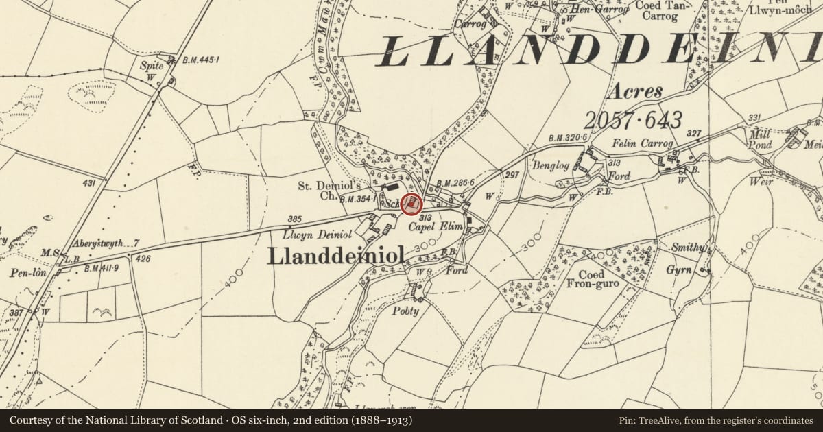
Slide toward Today to fade the historical sheet and see the modern map underneath.
David Rumsey Map Collection, Stanford LibrariesDavid Rumsey Map Collection, Stanford LibrariesDavid Rumsey Map Collection, Stanford LibrariesDavid Rumsey Map Collection, Stanford LibrariesDavid Rumsey Map Collection, Stanford Libraries
5 historical maps cover this location, the earliest the 1830 map "V.3:11-15:XV. Britisches Reich. A. Kon: England. b. Frstenthum Wales: Shire: 37-40" (David Rumsey Map Collection, Stanford Libraries).
Historical maps covering this location
- 1830 · V.3:11-15:XV. Britisches Reich. A. Kon: England. b. Frstenthum Wales: Shire: 37-40 (David Rumsey Map Collection, Stanford Libraries)
- 1883 · Watershed map England, Wales 3. (David Rumsey Map Collection, Stanford Libraries)
- 1896 · Sheet 7. Ordnance Survey of England and Wales. (David Rumsey Map Collection, Stanford Libraries)
- 1899 · 178 Llanilar (Hills) (David Rumsey Map Collection, Stanford Libraries)
- 1901 · Sheet 14. (David Rumsey Map Collection, Stanford Libraries)
Cadw's description
Location
Situated just below and to the E of Llanddeiniol Church, attached to Aberffrwd.
History
1827 National School built by the Rev. Thomas Richards of Carrog, now Church Hall. Aberffrwd, listed separately, was the schoolteacher's house.
Exterior
Description: Rubble stone with slate roof. Single-storey, four-window range of arched windows, outer windows slightly broader. Centre plaque N.S.1827 above and M.F.T.R. below. Glazing is not original, windows are said to have had delicate iron tracery as on Aberffrwd. Now outer windows have thick-barred 9-pane windows with intersecting bars in arched heads. Centre windows have plain centre mullion and six large panes. S end late C19 lean-to porch with black-brick dressings. Door to E and W sides. Originally there was a porch with single E door and main roof had a S bellcote.
Interior
Situated just below and to E of Llanddeiniol Church, attached to Aberffrwd.
Reason for designation
Of historic interest as a good example of the schoolrooms built by the Anglican church under the auspices of the National Schools Society.
Nearby in the register
- AberffrwdReligious, Ritual and Funeraryunder 1 mi
- Bridge to NE of AberffrwdTransportunder 1 mi
- Church of St DeiniolReligious, Ritual and Funeraryunder 1 mi
- CarrogDomesticunder 1 mi
Other entries of the same register within about three miles of this one, by straight line.