Cof Cymru: National Historic Assets of Wales · Wales
Rhydlas Uchaf
Llanrhystyd, Ceredigion, Wales
A Grade II listed building in Joppa, Llanrhsyd, Llanrhystyd, Ceredigion, designated on 9 August 1996.
The record
- Designation
- Listed building, Grade II
- Broad class
- Domestic
- Date of designation
- 9 August 1996
- Locality
- Joppa
- Town
- Llanrhsyd
- Community
- Llanrhystyd
- Unitary authority
- Ceredigion
- Country
- Wales
- Coordinates
- 52.28328, -4.10951
- Cadw reference
- 17134
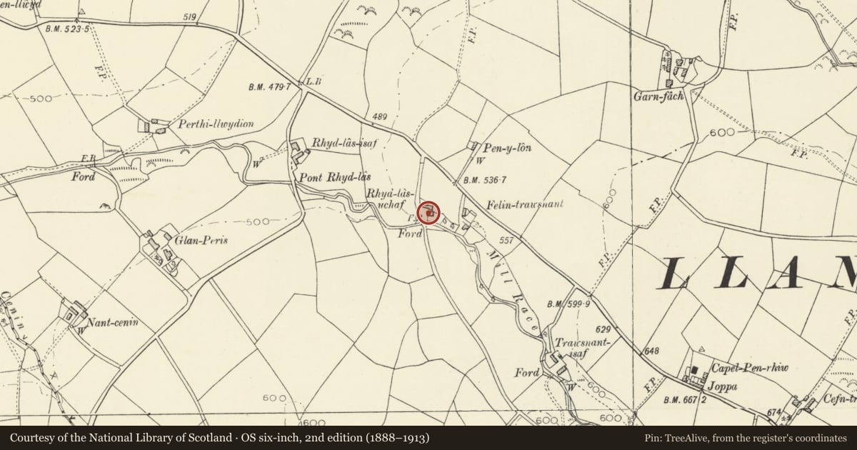
Slide toward Today to fade the historical sheet and see the modern map underneath.
David Rumsey Map Collection, Stanford LibrariesDavid Rumsey Map Collection, Stanford LibrariesDavid Rumsey Map Collection, Stanford LibrariesDavid Rumsey Map Collection, Stanford LibrariesDavid Rumsey Map Collection, Stanford Libraries
5 historical maps cover this location, the earliest the 1830 map "V.3:11-15:XV. Britisches Reich. A. Kon: England. b. Frstenthum Wales: Shire: 37-40" (David Rumsey Map Collection, Stanford Libraries).
Historical maps covering this location
- 1830 · V.3:11-15:XV. Britisches Reich. A. Kon: England. b. Frstenthum Wales: Shire: 37-40 (David Rumsey Map Collection, Stanford Libraries)
- 1896 · Sheet 7. Ordnance Survey of England and Wales. (David Rumsey Map Collection, Stanford Libraries)
- 1899 · 178 Llanilar (Hills) (David Rumsey Map Collection, Stanford Libraries)
- 1901 · Sheet 14. (David Rumsey Map Collection, Stanford Libraries)
- 1919 · Sheet 78. Lampeter. (David Rumsey Map Collection, Stanford Libraries)
Cadw's description
Location
Situated on E side of no-through road leading to Pencraig-Peris.
History
Early C19, indicated on the 1841 Tithe map, when owned by Rev. Morgan Evans and occupied by David Davies. Later C19 additions and alterations.
Exterior
Whitewashed rubble construction. Slate roof. Rubble gable chimney stacks, thicker to left, also stack to left lean-to, abutting house. Two bay front. Ground floor with 4-pane hornless sash windows, cambered stone voussoired heads. Two dormer windows with sloping "eyebrow" roofs, C20 glazing. Later rubble lean-to against left end with corrugated asbestos roof. Window to W (road) side with lintel and boarded door to rear. Later outshut to rear right with boarded door and 2-pane window to W.
Interior
Unusual plan, originally of two rooms with rear entry into the main one. Main ground floor room with three rough beams and modern fireplace. Six-panel door to parlour. Five-bay collar-truss roof structure. The E two pairs of trusses are rough with pegged collars and paired purlins. The others are later and sawn: perhaps this mixture is due to raising the roof to create attic rooms, reusing the best of the old timbers.
Reason for designation
Included as an unusual small vernacular farmhouse with attractive regional character.
Nearby in the register
- Mabws HallDomesticunder 1 mi
- CefnmabwsDomesticunder 1 mi
- Attached range of outbuildings at CefnmabwsAgriculture and Subsistenceunder 1 mi
- Rhos yr OlchfaDomestic1 mi
Other entries of the same register within about three miles of this one, by straight line.