Cof Cymru: National Historic Assets of Wales · Wales
Public Library
Porth, Rhondda Cynon Taff, Wales
A Grade II listed building in Porth, Rhondda Cynon Taff, designated on 1 August 1996.
The record
- Designation
- Listed building, Grade II
- Broad class
- Civil
- Date of designation
- 1 August 1996
- Locality
- Porth
- Town
- Porth
- Community
- Porth
- Unitary authority
- Rhondda Cynon Taff
- Country
- Wales
- Coordinates
- 51.61046, -3.40395
- Cadw reference
- 17118
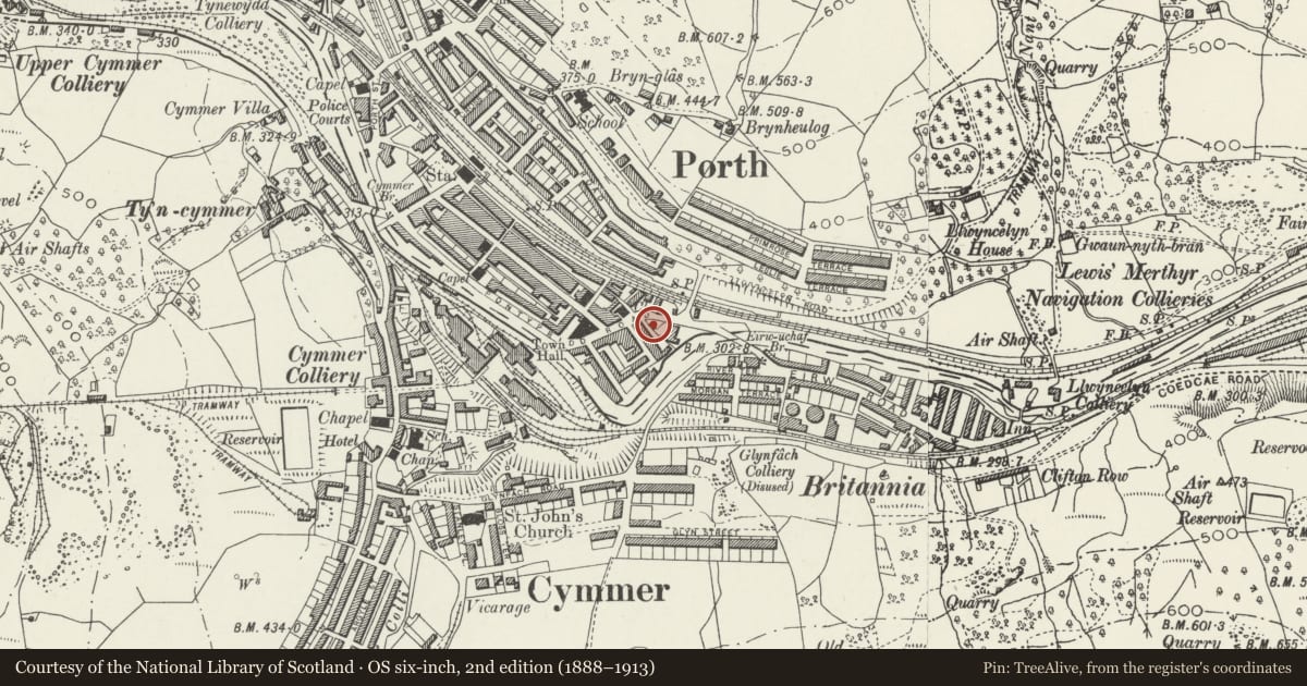
Slide toward Today to fade the historical sheet and see the modern map underneath.
David Rumsey Map Collection, Stanford LibrariesDavid Rumsey Map Collection, Stanford LibrariesDavid Rumsey Map Collection, Stanford LibrariesDavid Rumsey Map Collection, Stanford LibrariesDavid Rumsey Map Collection, Stanford Libraries
5 historical maps cover this location, the earliest the 1636 map "Cornubia : Devonia, Somersetus, Dorcestria, Wiltonia, Glocestria ..." (David Rumsey Map Collection, Stanford Libraries).
Historical maps covering this location
- 1636 · Cornubia : Devonia, Somersetus, Dorcestria, Wiltonia, Glocestria ... (David Rumsey Map Collection, Stanford Libraries)
- 1637 · The fourth table of England. Cornub. Devonia, Somerset etc. (David Rumsey Map Collection, Stanford Libraries)
- 1865 · England and Wales. England No. 6. (David Rumsey Map Collection, Stanford Libraries)
- 1895 · Sheet 11. Ordnance Survey of England and Wales. (David Rumsey Map Collection, Stanford Libraries)
- 1907 · 248 Pontypridd (Hills) (David Rumsey Map Collection, Stanford Libraries)
Cadw's description
Location
Situated in the S part of town centre, just W of railway and river bridges.
History
Former shops c1912, donated to town as a library in 1949 in memory of William Evans of Thomas and Evans, former major shopkeepers and suppliers of Porth, further reburbished by Borough Council 1980s.
Exterior
Of red brick in mainly Flemish bond and terracotta with Welsh slate roof rendered to side. A double gable and frontage comprising on first floor a pair of Venetian windows with moulded terracotta surrounds incorporating a keystone and moulded sill with replaced glazing and between them a small moulded blind window; above are 2 stepped gables with heavy moulded corniced finials surmounted by orbs and narrow louvred lights in each apex; ground floor has 4 terracotta caryatids on moulded pilasters and brackets and supporting large consoles, 2 at each end and 2 either side of main central entrance which has a moulded black marble surround; replaced fascia, glazing and brick lower front courses. To right a flat roofed wing comprising a pair of segmental arched doorways with moulded terracotta surrounds and cornice above, 1 ground floor and 2 upper floor windows with terracotta surrounds incorporating dripmould and keystone; replaced doors and glazing. Interior recently refurbished.
Reason for designation
Listed for the special interest of the terracotta detail to the main frontage.
Nearby in the register
- Former Central CinemaRecreationalunder 1 mi
- Gateway to Welsh Hills WorksCommercialunder 1 mi
- 25 Hannah StreetCommercialunder 1 mi
- Evan Howells Butchers ShopCommercialunder 1 mi
Other entries of the same register within about three miles of this one, by straight line.