Cof Cymru: National Historic Assets of Wales · Wales
Revetment wall, doorways and railings to Mount Pleasant
Porth, Rhondda Cynon Taff, Wales
A Grade II listed building in Porth, Rhondda Cynon Taff, designated on 1 August 1996.
The record
- Designation
- Listed building, Grade II
- Broad class
- Domestic
- Date of designation
- 1 August 1996
- Locality
- Porth
- Town
- Porth
- Community
- Porth
- Unitary authority
- Rhondda Cynon Taff
- Country
- Wales
- Coordinates
- 51.61193, -3.40994
- Cadw reference
- 17111
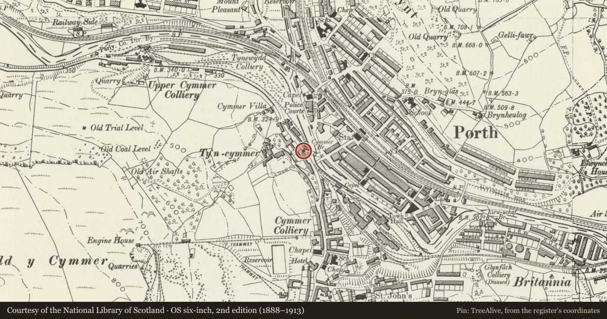
Slide toward Today to fade the historical sheet and see the modern map underneath.
David Rumsey Map Collection, Stanford LibrariesDavid Rumsey Map Collection, Stanford LibrariesDavid Rumsey Map Collection, Stanford LibrariesDavid Rumsey Map Collection, Stanford LibrariesDavid Rumsey Map Collection, Stanford Libraries
5 historical maps cover this location, the earliest the 1636 map "Cornubia : Devonia, Somersetus, Dorcestria, Wiltonia, Glocestria ..." (David Rumsey Map Collection, Stanford Libraries).
Historical maps covering this location
- 1636 · Cornubia : Devonia, Somersetus, Dorcestria, Wiltonia, Glocestria ... (David Rumsey Map Collection, Stanford Libraries)
- 1637 · The fourth table of England. Cornub. Devonia, Somerset etc. (David Rumsey Map Collection, Stanford Libraries)
- 1865 · England and Wales. England No. 6. (David Rumsey Map Collection, Stanford Libraries)
- 1895 · Sheet 11. Ordnance Survey of England and Wales. (David Rumsey Map Collection, Stanford Libraries)
- 1907 · 248 Pontypridd (Hills) (David Rumsey Map Collection, Stanford Libraries)
Cadw's description
Location
Situated on the W side of and facing Cymmer Bridge, a historic crossing point of River Rhondda.
History
Built 1861-1866, preceding the major development of Cymmer and Porth and perhaps associated with the earlier stages of mining at Ty Newydd and Cymmer Collieries and with Tynycymmer house just above to W.
Exterior
High battered revetment wall of 2 heights in coursed, occasionally snecked, rock faced sandstone. Four narrow pointed arched doorways with piers in coarse grained channelled concrete and wrought iron metal gates give access via steps to houses above; inscription plaques above record 'Mount Pleasant 1861 'Greenhill 1866', the other 2 blank; right end gateway whitened. Concrete coping and metal railings above.
Reason for designation
Listed as a well-detailed revetment set in a prominent position and with integral gateways.
Nearby in the register
- War MemorialCommemorativeunder 1 mi
- Bronwydd House and attached front terraceDomesticunder 1 mi
- Entrance gate piers and railings to BronwyddDomesticunder 1 mi
- Statue to William Evans in Bronwydd ParkCommemorativeunder 1 mi
Other entries of the same register within about three miles of this one, by straight line.