Cof Cymru: National Historic Assets of Wales · Wales
Eddystone House
Rhosllanerchrugog, Wrexham, Wales
A Grade II listed building in Rhosllanerchrugog, Wrexham, designated on 15 January 1996.
The record
- Designation
- Listed building, Grade II
- Broad class
- Domestic
- Date of designation
- 15 January 1996
- Locality
- Rhosllanerchrugog
- Community
- Rhosllanerchrugog
- Unitary authority
- Wrexham
- Country
- Wales
- Coordinates
- 53.01298, -3.04324
- Cadw reference
- 17093
Slide toward Today to fade the historical sheet and see the modern map underneath.
David Rumsey Map Collection, Stanford LibrariesDavid Rumsey Map Collection, Stanford LibrariesDavid Rumsey Map Collection, Stanford LibrariesDavid Rumsey Map Collection, Stanford LibrariesLlyfrgell Genedlaethol Cymru – The National Library of Wales
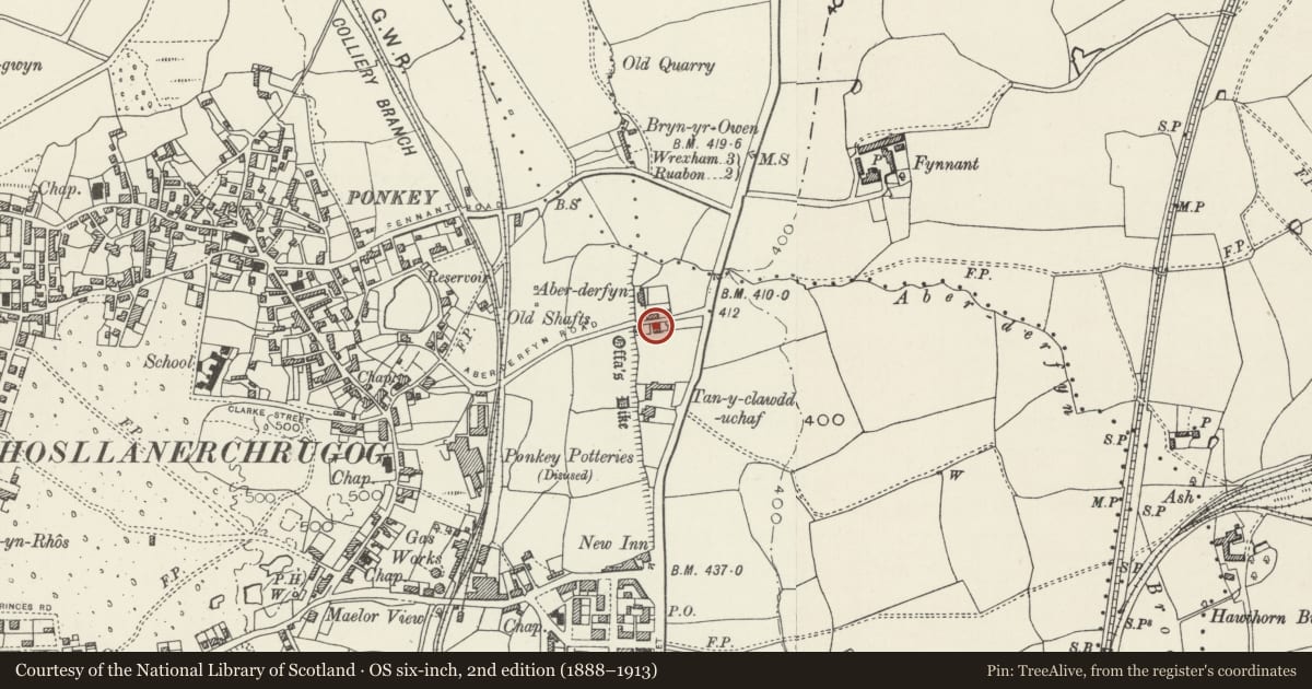
5 historical maps cover this location, the earliest the 1795 map "To Sir Watkin Williams-Wynn Bart ... the map of the six counties of North Wales is most humbly inscribed by his obedient humble servant" (Llyfrgell Genedlaethol Cymru – The National Library of Wales).
Historical maps covering this location
- 1795 · To Sir Watkin Williams-Wynn Bart ... the map of the six counties of North Wales is most… (Llyfrgell Genedlaethol Cymru – The National Library of Wales)
- 1883 · Watershed map England, Wales 3. (David Rumsey Map Collection, Stanford Libraries)
- 1898 · 121 Wrexham (Hills) (David Rumsey Map Collection, Stanford Libraries)
- 1898 · 121 Wrexham (Outline) (David Rumsey Map Collection, Stanford Libraries)
- 1901 · Sheet 9 and 10. (David Rumsey Map Collection, Stanford Libraries)
Cadw's description
Location
At the summit of a short rise from the main A48 on the N side of Johnstown, close to Offa's Dyke.
History
The house carries a date-stone of 1899, but most of the external detail suggests a date of c1830, and a house was shown here on the Tithe Map of 1845: it seems likely that the house was restored (and re-roofed) at the later date.
Exterior
Render, probably over brick; slate roof with tiled cresting. 2 storeys, double-pile plan comprising 2 parallel ranges. Central entrance in braced timber gabled porch, flanked by tripartite small-paned sash windows. 16-pane hornless sash windows above. Stair window in gable return, a small-paned sash with margin lights.
Reason for designation
Listed as a well-preserved and well detailed early C19 house.
Nearby in the register
- Offa's Dyke: Section S of Aberderfyn RoadLinear Earthworkunder 1 mi
- War MemorialCommemorativeunder 1 mi
- Offa's Dyke: Sections N & S of Bryn yr Owen CollieryLinear Earthworkunder 1 mi
- War MemorialCommemorativeunder 1 mi
Other entries of the same register within about three miles of this one, by straight line.