Cof Cymru: National Historic Assets of Wales · Wales
Barn at The Barn Farm
Llanwern, Newport, Wales
A Grade II listed building in Llanwern, Newport, designated on 19 December 1995.
The record
- Designation
- Listed building, Grade II
- Broad class
- Agriculture and Subsistence
- Date of designation
- 19 December 1995
- Locality
- Llanwern
- Community
- Llanwern
- Unitary authority
- Newport
- Country
- Wales
- Coordinates
- 51.58283, -2.91357
- Cadw reference
- 17078
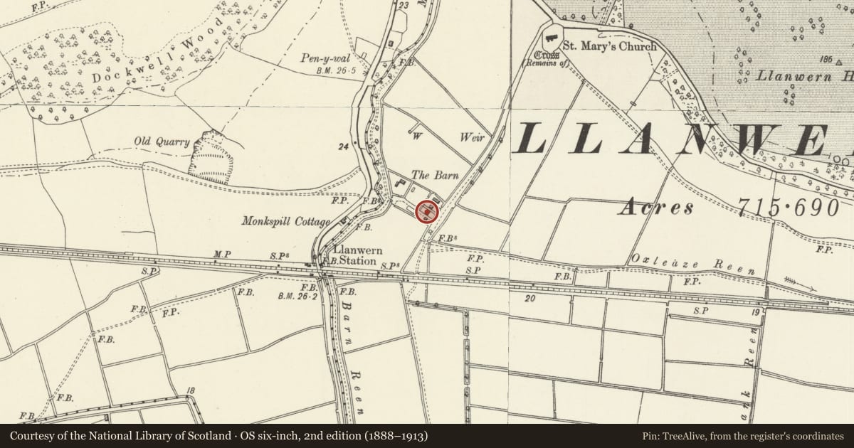
Slide toward Today to fade the historical sheet and see the modern map underneath.
David Rumsey Map Collection, Stanford LibrariesNational Library of ScotlandDavid Rumsey Map Collection, Stanford LibrariesDavid Rumsey Map Collection, Stanford LibrariesDavid Rumsey Map Collection, Stanford Libraries
5 historical maps cover this location, the earliest the 1636 map "Cornubia : Devonia, Somersetus, Dorcestria, Wiltonia, Glocestria ..." (David Rumsey Map Collection, Stanford Libraries).
Historical maps covering this location
- 1636 · Cornubia : Devonia, Somersetus, Dorcestria, Wiltonia, Glocestria ... (David Rumsey Map Collection, Stanford Libraries)
- 1865 · England and Wales. England No. 6. (David Rumsey Map Collection, Stanford Libraries)
- 1895 · Sheet 11. Ordnance Survey of England and Wales. (David Rumsey Map Collection, Stanford Libraries)
- 1913 · Sheet 102. Newport. (David Rumsey Map Collection, Stanford Libraries)
- 1963 · Map No. 2 - Local Government Commission for Wales : [Definitive maps showing proposed… (National Library of Scotland)
Cadw's description
Location
Set at the end of a long private drive to the SW of the Parish Church St Mary, on the SW side of Barn Farmhouse. Aligned on a NE/SW axis.
Exterior
Tall, seven bay barn, earlier C19. Probably part of the Home Farm to the Llanwern estate. Whitewashed rubble elevations. Slated, gabled roof. The long (SW and NE) elevations each have a large, central full-height cart doorway, partially blocked with three ventilation slots to either side at first floor level. At ground floor level are a series of six round-headed arches with voussoired heads, now blocked, originally giving access to some form of stalled undercroft, possibly for pigs. Pegged "A" frame roof with three trenched purlins and ridge beam and tie beams. NE gable has a large window with timber lintel, now blocked, with ventilation slot above. SW gable has modern opening to ground floor.
Reason for designation
Listed grade II as an unusually planned example of a large estate barn.
Nearby in the register
- St. Mary's Churchyard Cross, LlanwernCross baseunder 1 mi
- Parish Church of St MaryReligious, Ritual and Funeraryunder 1 mi
- Great MiltonDomesticunder 1 mi
- Thatched CottageDomesticunder 1 mi
Other entries of the same register within about three miles of this one, by straight line.