Cof Cymru: National Historic Assets of Wales · Wales
Pontithel House
Gwernyfed, Powys, Wales
A Grade II listed building in Pontithel, Gwernyfed, Powys, designated on 15 December 1995.
The record
- Designation
- Listed building, Grade II
- Broad class
- Domestic
- Date of designation
- 15 December 1995
- Locality
- Pontithel
- Community
- Gwernyfed
- Unitary authority
- Powys
- Country
- Wales
- Coordinates
- 52.02211, -3.21878
- Cadw reference
- 17055
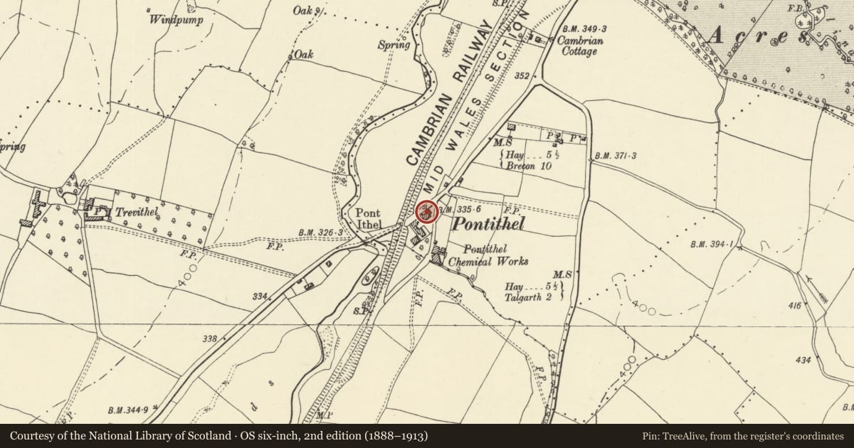
Slide toward Today to fade the historical sheet and see the modern map underneath.
David Rumsey Map Collection, Stanford LibrariesDavid Rumsey Map Collection, Stanford LibrariesDavid Rumsey Map Collection, Stanford LibrariesDavid Rumsey Map Collection, Stanford LibrariesDavid Rumsey Map Collection, Stanford Libraries
5 historical maps cover this location, the earliest the 1608 map "(13) Cambriae Typus." (David Rumsey Map Collection, Stanford Libraries).
Historical maps covering this location
- 1608 · (13) Cambriae Typus. (David Rumsey Map Collection, Stanford Libraries)
- 1636 · Cornubia : Devonia, Somersetus, Dorcestria, Wiltonia, Glocestria ... (David Rumsey Map Collection, Stanford Libraries)
- 1856 · 42. Brecon. (David Rumsey Map Collection, Stanford Libraries)
- 1896 · 214 Talgarth (Hills) (David Rumsey Map Collection, Stanford Libraries)
- 1901 · Sheet 14. (David Rumsey Map Collection, Stanford Libraries)
Cadw's description
Location
Located on the road from Brecon to Hay, approximately 150m E of Pont Ithel.
History
Early C19 house. Occupied in 1881 by the Manager of the former naphtha extraction works which stood to the rear and operated from the mid-late C19, working into the 1920's.
Exterior
A house of the early C19, of colourwashed stone with a slate roof. Two storeys, basement and attics. Three bays, with an attached outbuilding to the W gable end converted to accommodation in the late C20.
Central 6-panelled door in timber pilastered doorcase, the canopy missing. Sixteen paned sashes to ground and first floors, but 12-pane sash over door; all opening with cambered heads and stone sills. Gable stacks. Windows to attics in gable ends.
Front garden railings and gates set on a low wall, taking up slope of the ground. The rails are looped round-section iron bars, threaded through horizontal iron flats. Stanchions have pointed finials. Central gate, and a secondary gate to the left with dog rails.
Reason for designation
Included as a well preserved early C19 house.
Nearby in the register
- 4 Pontithel CottagesDomesticunder 1 mi
- 5 Pontithel CottagesDomesticunder 1 mi
- Pontithel (partly in the Bronllys community)Transportunder 1 mi
- Pontithel (partly in Gwernyfed community)Transportunder 1 mi
Other entries of the same register within about three miles of this one, by straight line.