Cof Cymru: National Historic Assets of Wales · Wales
Cowhouse at Gilwen
Cilycwm, Carmarthenshire, Wales
A Grade II listed building in Gilwen, Cilycwm, Carmarthenshire, designated on 29 November 1995.
The record
- Designation
- Listed building, Grade II
- Broad class
- Agriculture and Subsistence
- Date of designation
- 29 November 1995
- Locality
- Gilwen
- Community
- Cilycwm
- Unitary authority
- Carmarthenshire
- Country
- Wales
- Coordinates
- 52.03258, -3.82765
- Cadw reference
- 16999
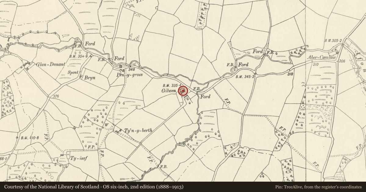
Slide toward Today to fade the historical sheet and see the modern map underneath.
David Rumsey Map Collection, Stanford LibrariesDavid Rumsey Map Collection, Stanford LibrariesDavid Rumsey Map Collection, Stanford LibrariesDavid Rumsey Map Collection, Stanford LibrariesDavid Rumsey Map Collection, Stanford Libraries
5 historical maps cover this location, the earliest the 1860 map "41. Caermathen." (David Rumsey Map Collection, Stanford Libraries).
Historical maps covering this location
- 1860 · 41. Caermathen. (David Rumsey Map Collection, Stanford Libraries)
- 1891 · Sheet 10. Ordnance Survey of England and Wales. . (David Rumsey Map Collection, Stanford Libraries)
- 1898 · 212 Llandovery (Hills) (David Rumsey Map Collection, Stanford Libraries)
- 1898 · 212 Llandovery (Outline) (David Rumsey Map Collection, Stanford Libraries)
- 1901 · Sheet 14. (David Rumsey Map Collection, Stanford Libraries)
Cadw's description
History
Early C19 barn range with cow-house at right angles, marked on 1845 Tithe Map.
Exterior
Whitewashed, rubble stone with slate roofs. Barn is long range under single roof, lofted cart-house to left, barn to right. Two cart-entries to left with stone pier between, timber lintels and single loft window over second entry. Barn to right has loop, high door, two loops and second high door, the first high door roughly central to whole range. Timber lintels to doors. S end wall has loft door, former steps removed. Rear has similar high doors and loops. N end wall has three loops. Cow-house has lower roof, and six doors with timber lintels, five to cow-house, sixth to separate end stall. Second and fourth doors are part-blocked. One rear wall door. Loft light in E end gable.
Interior
Barn has 6-bay roof of large tie-beam-and-collar pegged trusses. Cow-house has unusually broad span tie-beam trusses to 6-bay roof, three with thin angle struts. Internal loft-opening to end section, which has two trusses.
Reason for designation
Included for group value with old farmhouse as representative example in this area of traditional three-sided yard.
Nearby in the register
- Barn at GilwenAgriculture and Subsistenceunder 1 mi
- GilwenDomesticunder 1 mi
- Roman Road c. 250m SSW of Gilwen FarmRoadunder 1 mi
- Barn to N of of Cefn TrenfaAgriculture and Subsistenceunder 1 mi
Other entries of the same register within about three miles of this one, by straight line.