Cof Cymru: National Historic Assets of Wales · Wales
Puddleducks (including forecourt walls and railings)
Holt, Wrexham, Wales
A Grade II listed building in Holt, Wrexham, designated on 17 July 1996.
The record
- Designation
- Listed building, Grade II
- Broad class
- Domestic
- Date of designation
- 17 July 1996
- Locality
- Holt
- Community
- Holt
- Unitary authority
- Wrexham
- Country
- Wales
- Coordinates
- 53.07771, -2.88315
- Cadw reference
- 16958
Slide toward Today to fade the historical sheet and see the modern map underneath.
David Rumsey Map Collection, Stanford LibrariesDavid Rumsey Map Collection, Stanford LibrariesDavid Rumsey Map Collection, Stanford LibrariesDavid Rumsey Map Collection, Stanford LibrariesDavid Rumsey Map Collection, Stanford Libraries
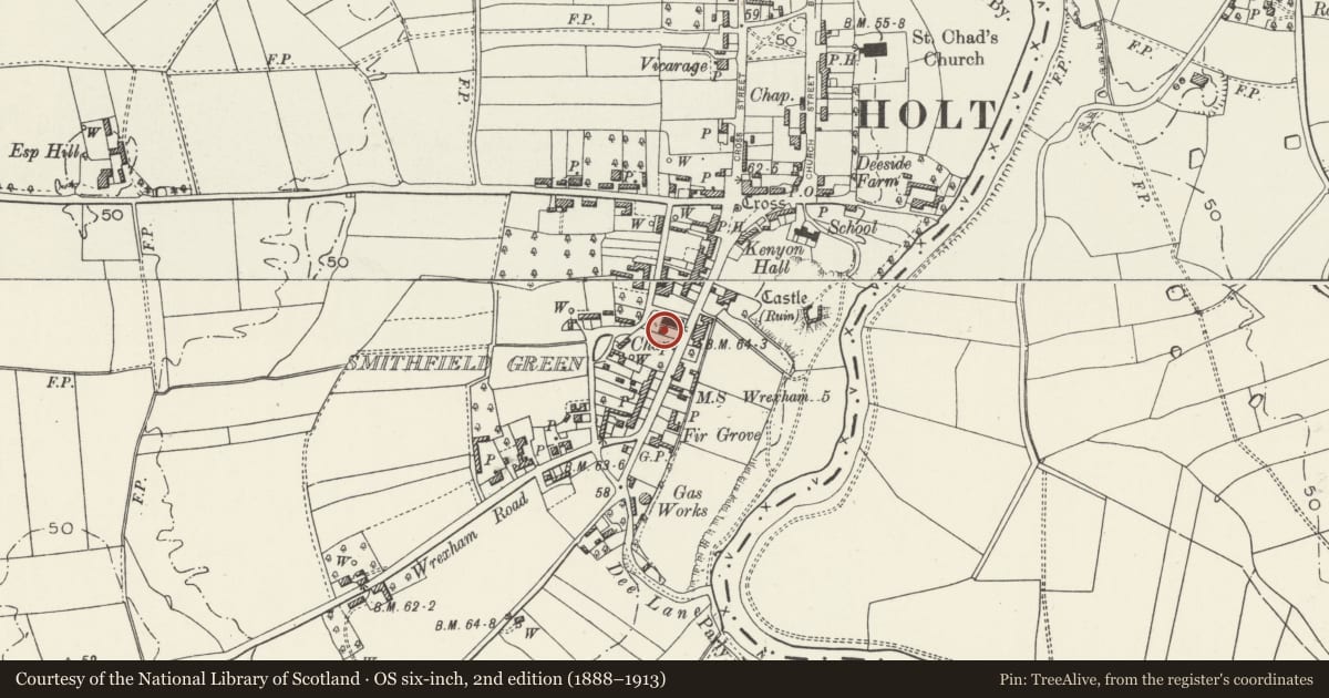
5 historical maps cover this location, the earliest the 1608 map "(13) Cambriae Typus." (David Rumsey Map Collection, Stanford Libraries).
Historical maps covering this location
- 1608 · (13) Cambriae Typus. (David Rumsey Map Collection, Stanford Libraries)
- 1861 · 73. Market Drayton. (David Rumsey Map Collection, Stanford Libraries)
- 1883 · Watershed map England, Wales 3. (David Rumsey Map Collection, Stanford Libraries)
- 1897 · 122 Nantwich (Hills) (David Rumsey Map Collection, Stanford Libraries)
- 1901 · Sheet 9 and 10. (David Rumsey Map Collection, Stanford Libraries)
Cadw's description
Location
Situated on the W side of Castle Street, set back in its own garden bordered by cast iron railings, continuous with those in front of the adjacent Presbyterian Church.
History
The Former Manse to the adjacent Presbyterian Church. Possibly also designed by T.M. Lockwood, c1865.
Exterior
c1865, 2 storeys, red brick symmetrical front with end brick chimneys. Double-pile plan. Central gabled porch, with brick dentilled eaves cornice, painted black; modern door. To either side large canted bay windows to ground floor. Two 12-pane sashes under dormers at first floor. To rear roughcast painted white, C20 door and porch with a number of sash windows.
Reason for designation
Listed for group value with the Presbyterian Church.
Nearby in the register
- Presbyterian Church (including forecourt walls and railings)Religious, Ritual and Funeraryunder 1 mi
- Former Baptist Chapel (including forecourt walls, gates and railings)Religious, Ritual and Funeraryunder 1 mi
- 1 Holt Hall (including the Peking Garden)Domesticunder 1 mi
- 2 Holt Hall (including the Peking Garden)Domesticunder 1 mi
Other entries of the same register within about three miles of this one, by straight line.