Cof Cymru: National Historic Assets of Wales · Wales
Trefriw Hall
Trefriw, Conwy, Wales
A Grade II listed building in Trefriw, Conwy, designated on 30 May 1996.
The record
- Designation
- Listed building, Grade II
- Broad class
- Domestic
- Date of designation
- 30 May 1996
- Locality
- Trefriw
- Town
- Trefriw
- Community
- Trefriw
- Unitary authority
- Conwy
- Country
- Wales
- Coordinates
- 53.15155, -3.82423
- Cadw reference
- 16928
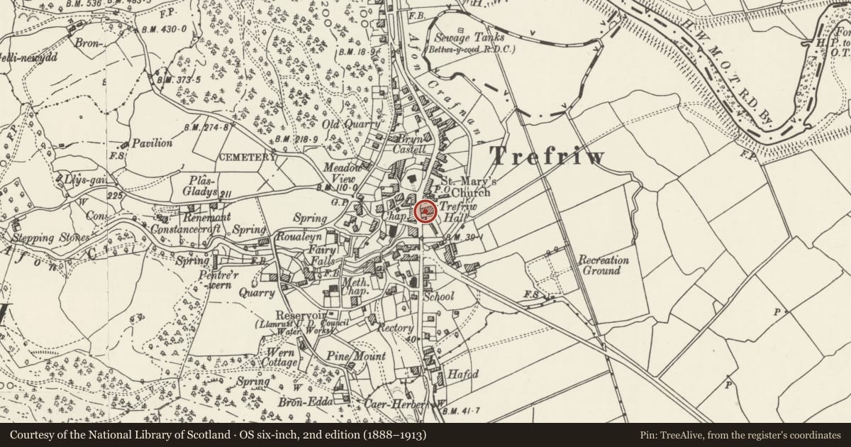
Slide toward Today to fade the historical sheet and see the modern map underneath.
David Rumsey Map Collection, Stanford LibrariesDavid Rumsey Map Collection, Stanford LibrariesDavid Rumsey Map Collection, Stanford LibrariesLlyfrgell Genedlaethol Cymru – The National Library of WalesDavid Rumsey Map Collection, Stanford Libraries
5 historical maps cover this location, the earliest the 1795 map "To Sir Watkin Williams-Wynn Bart ... the map of the six counties of North Wales is most humbly inscribed by his obedient humble servant" (Llyfrgell Genedlaethol Cymru – The National Library of Wales).
Historical maps covering this location
- 1795 · To Sir Watkin Williams-Wynn Bart ... the map of the six counties of North Wales is most… (Llyfrgell Genedlaethol Cymru – The National Library of Wales)
- 1883 · Watershed map England, Wales 3. (David Rumsey Map Collection, Stanford Libraries)
- 1899 · 106 Bangor (Outline) (David Rumsey Map Collection, Stanford Libraries)
- 1899 · 106 Bangor (Hills) (David Rumsey Map Collection, Stanford Libraries)
- 1901 · Sheet 9 and 10. (David Rumsey Map Collection, Stanford Libraries)
Cadw's description
Location
Set back from the main street in the town centre, partly obscured by later housing on the street-line in front.
Exterior
Early C19 village hall in restrained classical style with pedimented ends. Of rubble construction on a narrow plinth with slate-stone and sandstone dressings and a shallow-pitched slate roof. Heavy entablature and quoins of dressed slate, the former of 3 tiers and returned to form eaves decoration on the sides. On each of the long (E and W) sides, three tall, 24-pane recessed sash windows with plain projecting architraves and projecting compound keystones; these of sandstone with a broader slate-stone section beneath; plain cill-band, returned around N and S ends. Modern entrances below the southern-most windows on both sides; deeply recessed part-glazed doors. The symmetrical (N) entrance front has 2 similar windows flanking a central entrance (now with boarded upper section). Adjoining the entrance facade and stepped-down, a slightly narrower low, single-storey modern extension, an out-of-character addition; flat roof. Further modern extension to the rear with central entrance.
Interior
Interior not accessible at time of inspection (February 1996).
Reason for designation
Listed despite out-of-character additions as a late Georgian hall of simple classical elegance.
Nearby in the register
- Plas CochDomesticunder 1 mi
- Llys LlewelynDomesticunder 1 mi
- Tan-yr-YwDomesticunder 1 mi
- Glan-y-DdolDefenceunder 1 mi
Other entries of the same register within about three miles of this one, by straight line.