Cof Cymru: National Historic Assets of Wales · Wales
Church of St Mary
Bagillt, Flintshire, Wales
A Grade II listed building in Bagillt, Flintshire, designated on 8 December 1995.
The record
- Designation
- Listed building, Grade II
- Broad class
- Religious, Ritual and Funerary
- Date of designation
- 8 December 1995
- Community
- Bagillt
- Unitary authority
- Flintshire
- Country
- Wales
- Coordinates
- 53.26705, -3.16703
- Cadw reference
- 16910
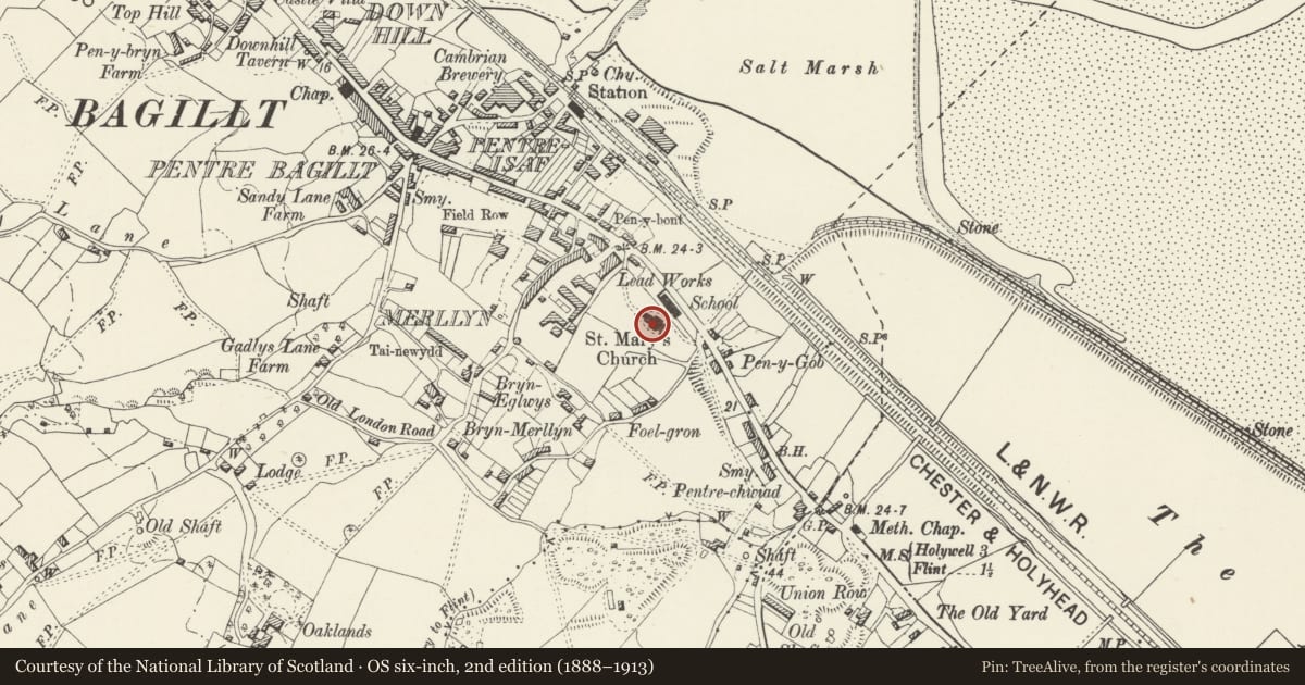
Slide toward Today to fade the historical sheet and see the modern map underneath.
David Rumsey Map Collection, Stanford LibrariesDavid Rumsey Map Collection, Stanford LibrariesLlyfrgell Genedlaethol Cymru – The National Library of WalesDavid Rumsey Map Collection, Stanford LibrariesDavid Rumsey Map Collection, Stanford Libraries
5 historical maps cover this location, the earliest the 1795 map "To Sir Watkin Williams-Wynn Bart ... the map of the six counties of North Wales is most humbly inscribed by his obedient humble servant" (Llyfrgell Genedlaethol Cymru – The National Library of Wales).
Historical maps covering this location
- 1795 · To Sir Watkin Williams-Wynn Bart ... the map of the six counties of North Wales is most… (Llyfrgell Genedlaethol Cymru – The National Library of Wales)
- 1830 · V.3:11-15:XV. Britisches Reich. A. Kon: England. b. Frstenthum Wales: Shire: 37-40 (David Rumsey Map Collection, Stanford Libraries)
- 1830 · V.3:11-15:XV. Britisches Reich. A. Kon: England. a. England ab sich: Shire: 35-36 (David Rumsey Map Collection, Stanford Libraries)
- 1883 · Watershed map England, Wales 3. (David Rumsey Map Collection, Stanford Libraries)
- 1901 · Sheet 9 and 10. (David Rumsey Map Collection, Stanford Libraries)
Cadw's description
Location
In large churchyard above High Street.
Exterior
Built 1837-38 by John Welch, architect.
Exterior: Yellow sandstone, coursed, slate roofs. Cruciform plan, with lancets, gabled buttresses and low pitched roofs. West tower with parapet of stepped battlements, corbelled out; 2 windows to each side at bell stage, lozenge to W, shallow buttresses, blind windows to sides, to W, round-headed doorway with shallow hood. Three bays to nave (gabled buttresses) doorway to N has round head, shallow hood. Transepts and E end have pairs of buttresses carried up as octagonal pinnacles; 3 lancets between buttresses (almond-shaped window above), single lancets to ends (and to returns); E end similar to transept ends but has low polygonal vestry with buttresses rising above parapet.
Interior: Spacious interior has open roof to aisleless nave (gallery to W end on octagonal columns) and broad crossing arches with boarded roof.
Listed as good example of earlier C19 Gothic.
References: E Hubbard, Clwyd, (Buildings of Wales Series), 1986, pp 319.
Nearby in the register
- Forester's Hall (Cocoa Rooms)Recreationalunder 1 mi
- Bagillt Gaol (Lock Up)Civilunder 1 mi
- Porch CottageDomesticunder 1 mi
- Bettisfield Colliery Winding Engine House and HeapsteadIndustrialunder 1 mi
Other entries of the same register within about three miles of this one, by straight line.